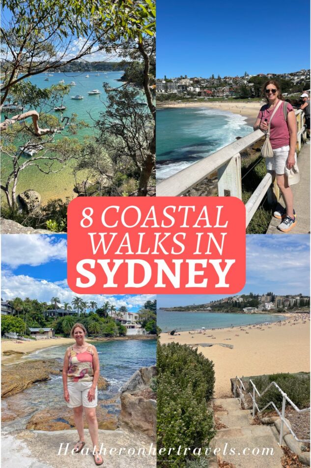
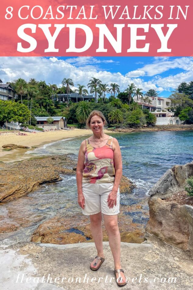
There are so many beautiful coastal walks in Sydney, that it’s difficult to choose a favourite from those I tried. The city is set within a large natural harbour, where the water tends to be calmer, with numerous inlets, beaches and viewpoints.
You can also walk overlooking the ocean around Bondi and Manly, which are known for their crashing waves and stunning seascapes. All of these walks can be reached within an hour from central Sydney using public transport, are easy to follow and suitable for any level of fitness.
In each section there’s a map showing the routes, and you can click through to follow more easily and work out which location will suit you best.
This article may contain affiliate links that provide commission on purchases you make at no extra cost to you. As an Amazon Associate I earn from qualifying purchases.
Top 3 coastal walks in Sydney
If you don’t have much time in Sydney, these are my top 3 walks to try first.
- Bondi to Coogee beach – The best known of Sydney coastal walks, taking in a succession of popular surfing beaches on the ocean side.
- Watsons Bay to Rose Bay – A series of lovely coves for swimming on the harbour side, as well as visiting historic Vaucluse House.
- Manly to Spit Bridge – On the north side of the harbour with some lovely secluded beaches and great views from Dobroyd Head over the harbour.
5 more Sydney coastal walks we recommend
In this article we also describe:
- Wooloomaloo to Darling harbour – skirting the botanical garden and Barangaroo Reserve, this walk strings together some of Sydney’s top landmarks, like the Sydney Opera House and Harbour Bridge.
- Watsons Bay Headland – a short walk around Watsons Bay and South Head at the mouth of Sydney Harbour, that can be tacked on to the Watsons Bay to Rose Bay walk.
- Coogee to Maroubra – an extension of the Bondi to Coogee walk, following the rocky clifftop south, with wild coastal landscapes and lovely rock pools to swim.
- Manly – Shelly Beach – North Head – from the surf beach at Manly and more protected Shelly beach, this walk covers the clifftop paths and views of North Head at the mouth of Sydney Harbour.
- Manly to Curl Curl Beach – a clifftop walk passing the beaches to the north of Manly, that could be combined with the Manly – Shelly Beach – North Head walk.
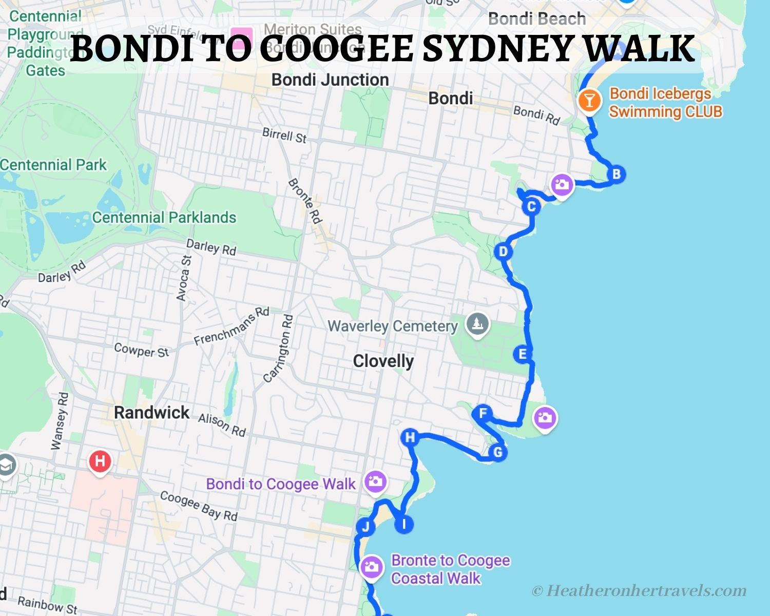
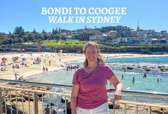
1. Bondi to Coogee
Sydney has numerous beautiful coastal trails, but best known is the Bondi to Coogee walk, between two of Sydney’s most popular Eastern beaches.
The route skirts the clifftop and rocky shoreline, passing a string of lovely beaches, with stunning views as each bay unfolds. It’s a chance to enjoy the scenery with numerous opportunities for a swim or coffee along the way.
Highlights – Bondi to Cooggee walk
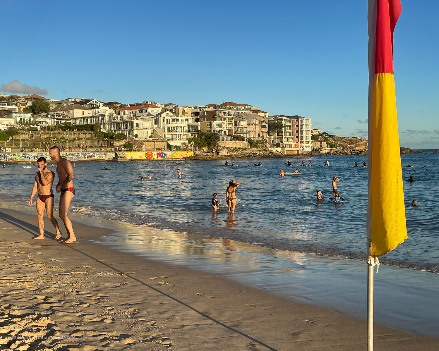
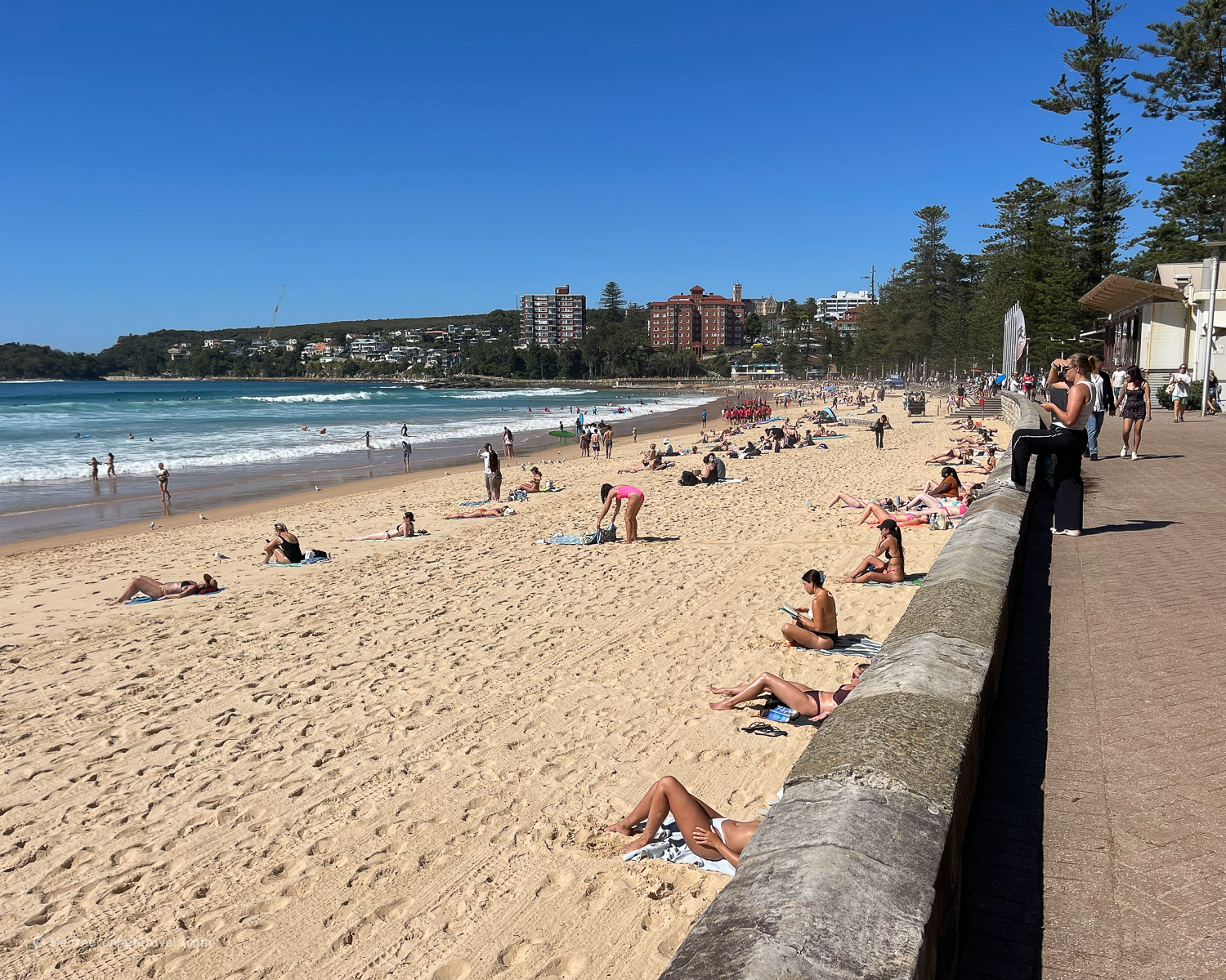
Bondi Beach – Sydney’s best known beach offers a broad expanse of sand and is popular for surfers. It’s worth a stop at the Pavilion, built in the 1930s and now restored as a cafe, arts and community hub. Admire the murals along the promenade, shop for fashion on Campbell Parade or enjoy brunch in one of the many cafes.
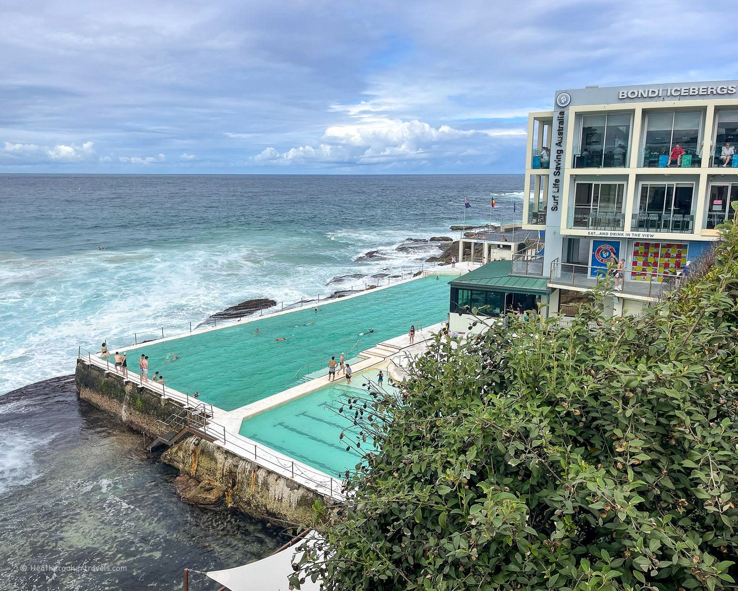
Swim at Icebergs – Head towards Bondi’s famous ocean pool, located at the south end of the beach. It’s a good place to swim if you find the crashing surf a little too challenging. From here continue south following the coast path, with steps up to the grassy headland at St Mark’s Park.
Mackenzie Point Lookout – this lookout spot on the cliffs is a favourite spot for whale watching. From August to November the humpback whales and their calfs can be seen playing offshore, as they make their southern migration.
Tamarama Beach – the clifftop viewpoint before arriving at Tamarama is a great place for photos of the coastline as you look south. The beach itself offers rolling surf, with a stretch of sand backed by grass and a cafe tucked into the southern sea wall.
Bronte Beach – a great beach to swim and sunbathe, with a rock pool and ocean swimming pool as well as the sea (be sure to swim between the flags). Grassy Bronte park has shaded picnic booths and there are several cafes on Bronte Road.
In 2026 building work is underway to redevelop the Lifesaving Club, expected to complete in 2027. It slightly marrs the beach atmosphere, although all facilities are operational.
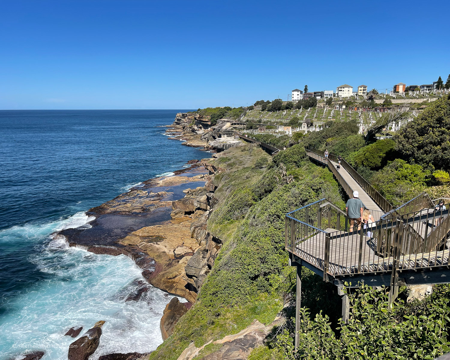
Waverley Cemetery – leaving the southern end of Bronte Beach, you soon reach a coastal boardwalk that zig zags along the edge of the cliff. It’s an incongruous sight to pass the large Waverley Cemetery set on the clifftop, where many of Sydney’s notable residents have been buried since the 19th century.
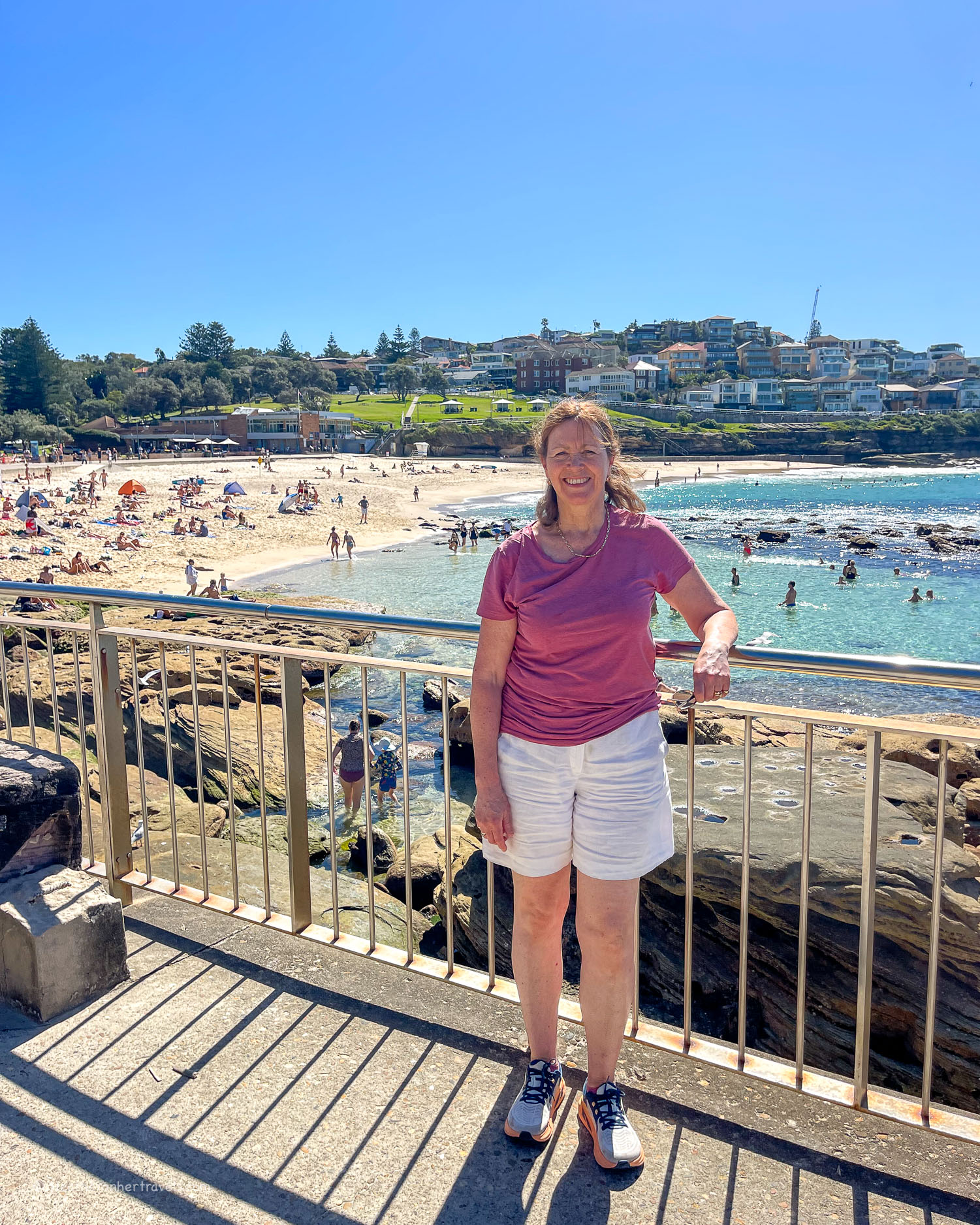
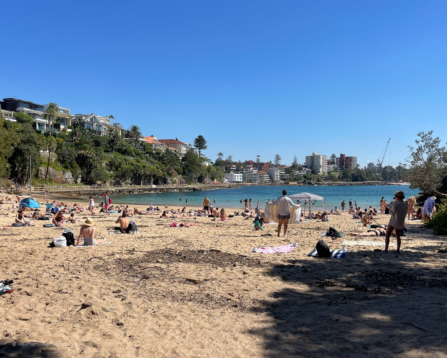
Clovelly Bay – The bay forms a deep inlet into the coastline, which makes it a good spot for sea swimming, since a large part of inlet is protected from the surf.
The sides of the inlet are re-enforced by flat concrete and there is also a small sandy beach. A pleasant restaurant Seasalt Clovelly perches on the side of the cliff overlooking the bay.
Gordons Bay – After passing the cafe and car park on the south side of Clovelly Bay, the path now brings you around the headland and skirts around Gordon’s Bay. There’s only a small area of sand here, but many people like to sunbathe and swim from the rocks, as the sea is clear and protected.
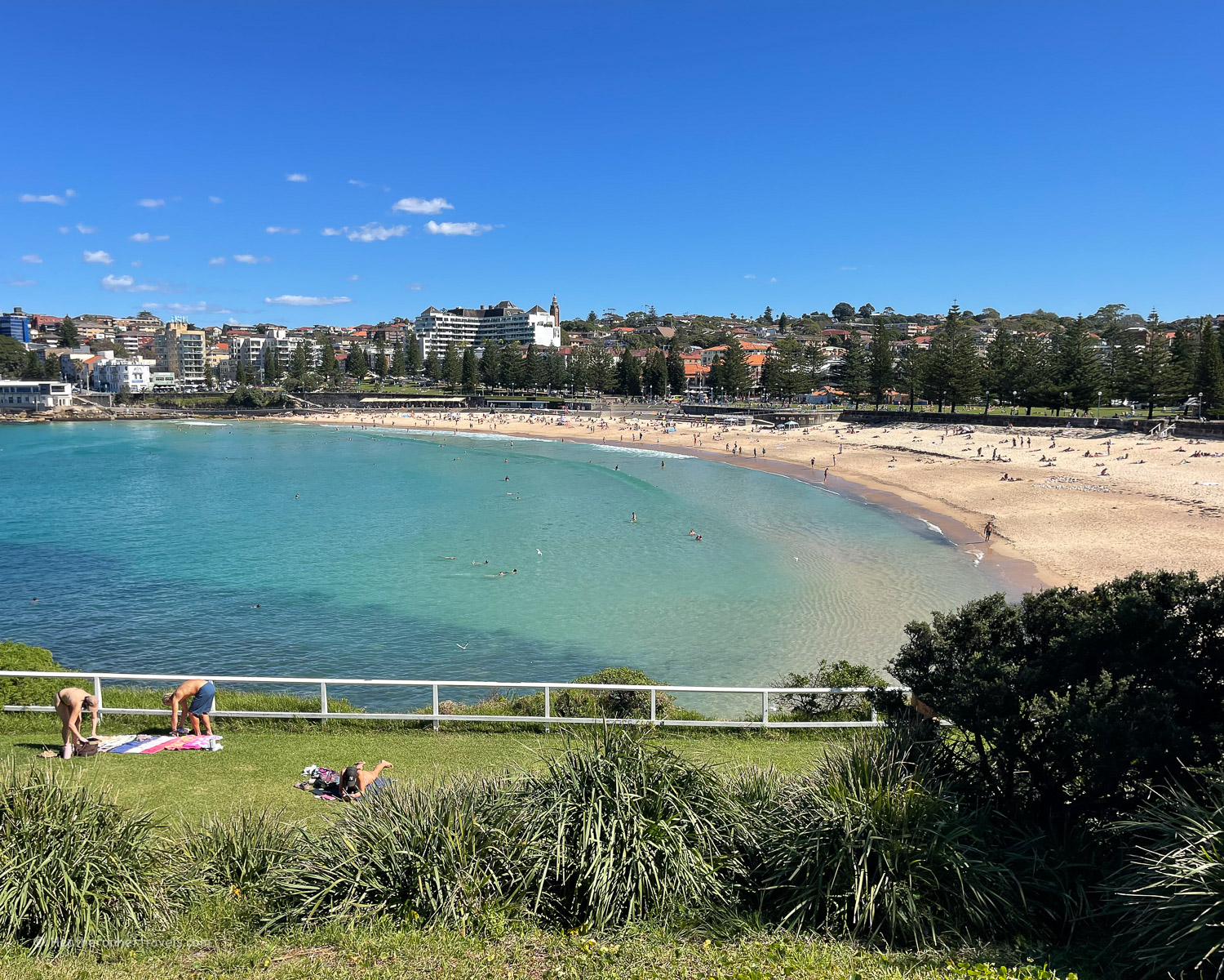
Coogee Beach – one of the most popular beaches in the Eastern Suburbs, the water here tends to be calmer than Bondi beach, due to the protection from Wedding Cake Island.
There are a number of seawater swimming pools such as Giles Baths, Ross Jones Rockpool (by the Life Saving Club), McIver’s Ladies Baths (Women and children only) and Wylie’s Baths.
Our walk ends here, but you could continue on the coastal path to Maroubra beach (described later in this article) or return by bus via Bondi Junction.
Planning – Bondi to Coogee walk
- It can be walked in either direction, but most people start at Bondi beach
- As one of Sydney’s most popular walks, this can get very busy on a sunny weekend.
- The walk can be extended by continuing from Coogee to Maroubra, also covered in this article.
- Takes around 1.5-2 hours to walk one way with no stops, but allow extra for swims, cafe stops and photos along the way.
- Distance is around 6 km one way
- Recommended cafes: Speedos North Bondi, the 3 cafes at the Pavilion overlooking Bondi Beach, Tamarama Beach Kiosk, Bronte Belo by Bronte Park, Seasalt Covelly, Bronte Belo at Coogee Beach.
Map – Bondi to Coogee walk
Access the route map for the Bondi to Coogee walk here or click on image below
Transport – Bondi to Coogee walk
Bondi Beach: Bus 333 from central Sydney (Circular Quay or Martin Place) to Bondi Beach. Alternatively T4 train line Martin Place to Bondi Junction, then bus 333 or 380 to Bondi Beach. Journey time around 45-60 mins.
Bronte Beach – Bus 379 between Bronte Beach Terminus and Bondi Junction.
Coogee Beach – Bus 350 bus between Coogee Beach and Bondi Junction.
Accommodation options
Bondi hotels
The walk can be reached by bus from most places in Sydney – but if you want to stay on Bondi Beach, check out these accommodation options
Read More
Read more about this walk: The Bondi to Coogee walk – a scenic coastal trail in Sydney

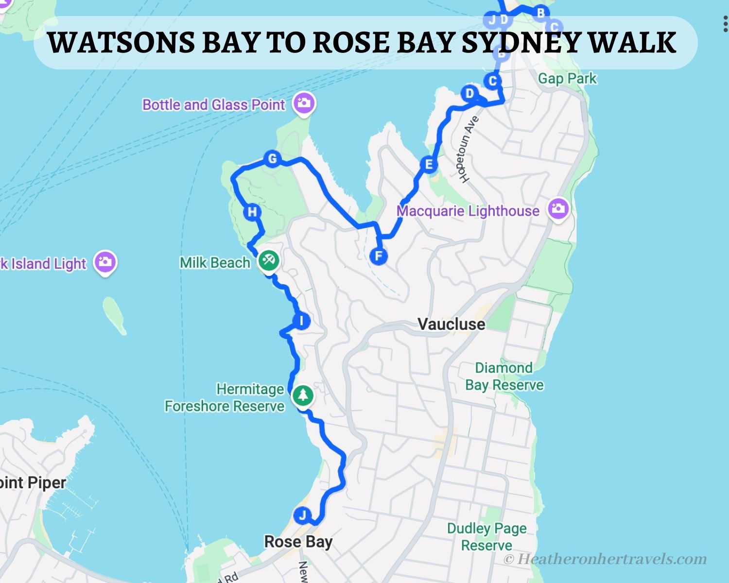
2. Watsons Bay to Rose Bay
This walk was one of my favourites (I did it twice!), with a succession of lovely coves for swimming on the harbour side. As the beaches here are more secluded, it’s one of the best Sydney coastal walks for swimming, with calmer water than on the ocean side.
Anyone interested in Australia’s colonial era can also stop halfway to visit historic Vaucluse House, a 19th century mansion and estate (free entry). If you start at Watson’s Bay, you could combine this with the shorter Watsons’s Bay headland walk.
Highlights – Watsons Bay to Rose Bay
Watsons Bay – this suburb of Sydney has a village feel, with historic cottages in Green Point, a sailing club and Robertson’s Park. It’s a popular spot to visit by ferry from Circular Quay, and known for Doyle’s restaurant and takeaway counter, serving fish and chips or other seafood dishes (watch out for swooping seagulls!).
From here you could walk past Camp Cove, up onto the headland, which I’ve covered separately in the Watsons Bay Headland Walk. But for this walk we’ll head along the beach, past the pretty tea garden of Baithouse cafe before climbing up the path behind Gibson’s Beach.
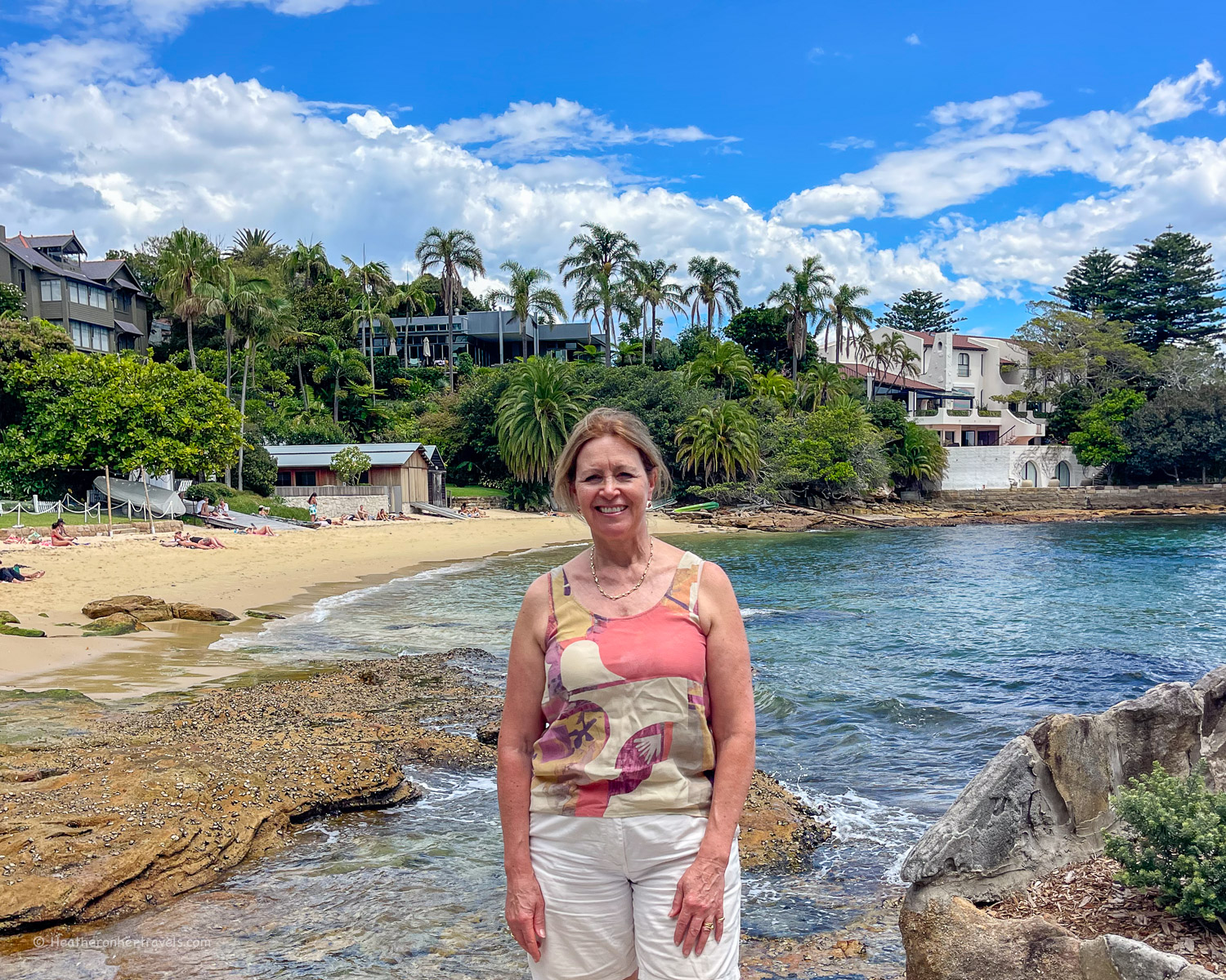
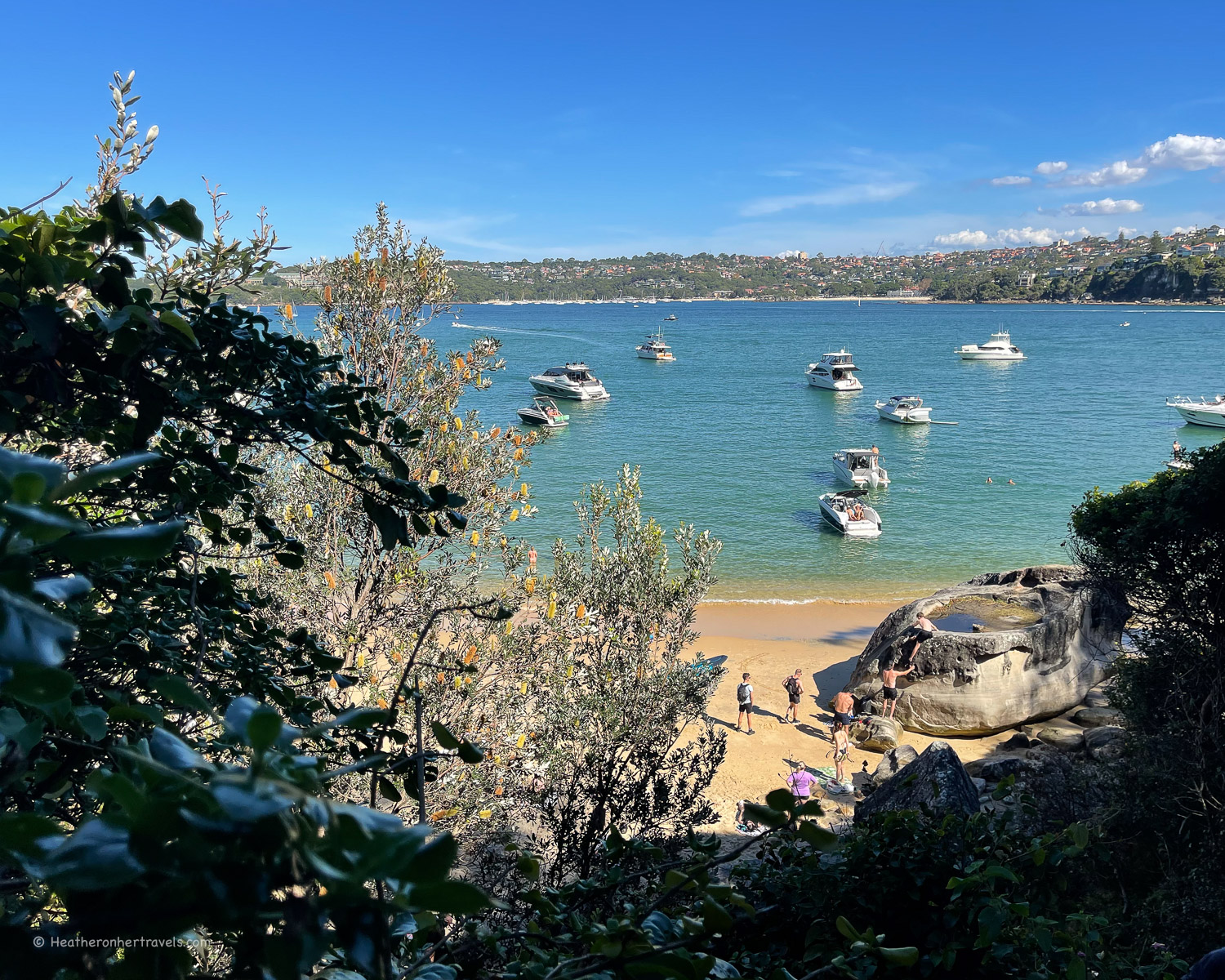
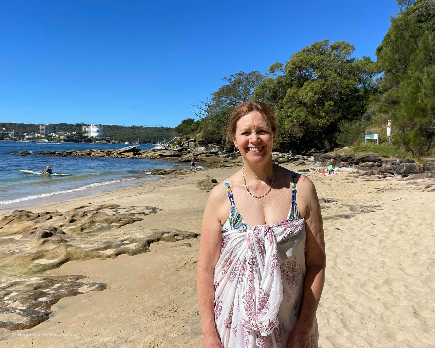
Kutti Beach – this small and idyllic beach is tucked away down a residential road, a lovely place to swim and relax, overlooked by the Vaucluse sailing club and some impressive homes with their boathouses.
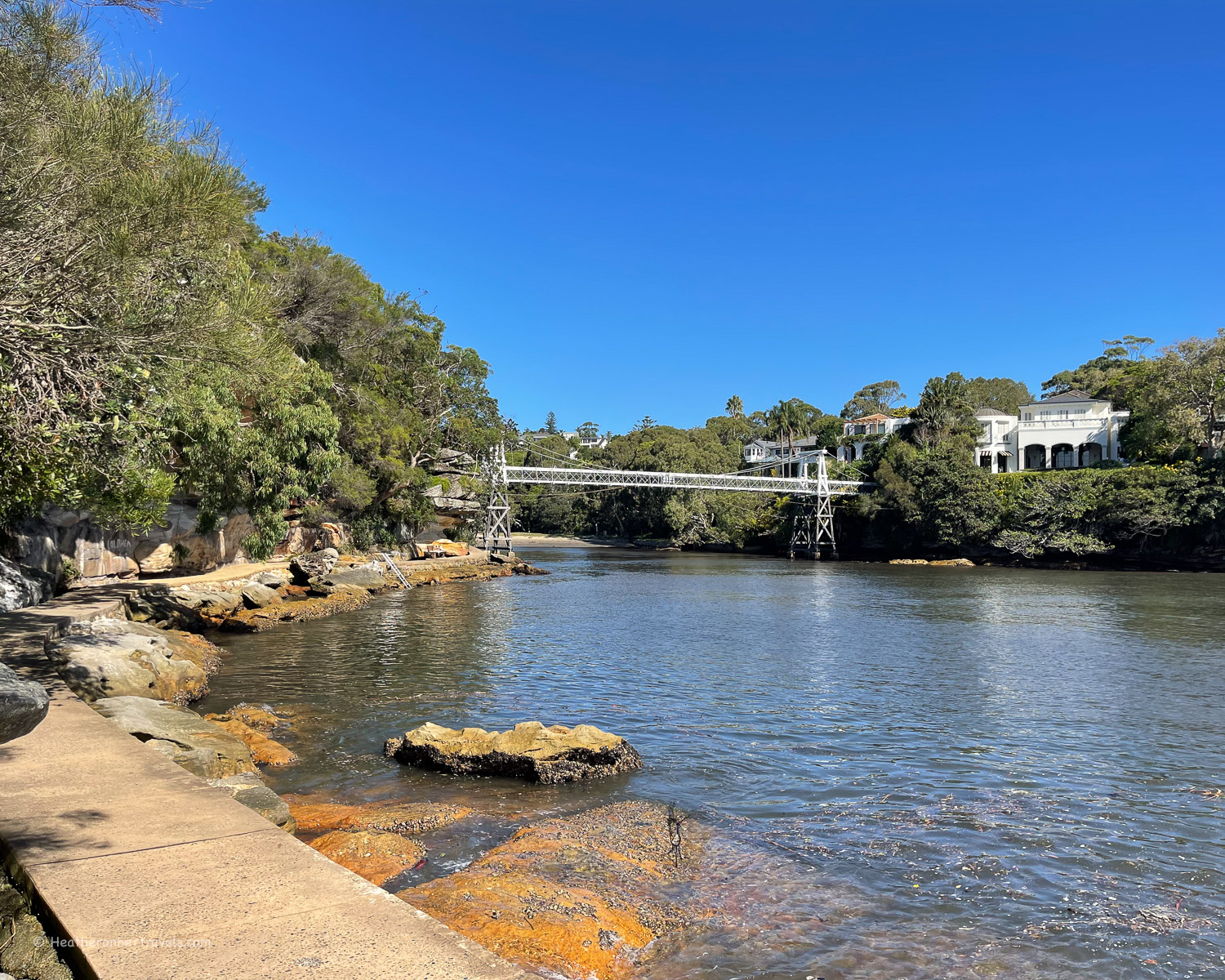
Parsley Bay – a short walk behind residential houses brings you to Parsley Bay Wharf, at the mouth of a narrow inlet that is netted for swimming. There is a beach at the end of the inlet, but we found that swimming from the rocks was a more attractive option.
Follow the path over the Parsley Bay suspension bridge and along residential roads, admiring some of the most expensive and sought after homes in Sydney.
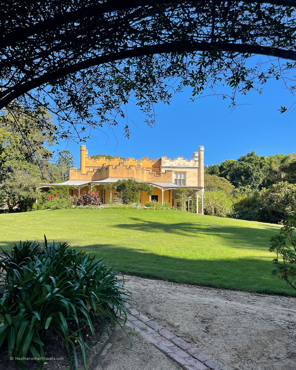
Vaucluse House – you’ll next arrive at the green space of Vaucluse Park, where the beach has a muddy feel, so we’d recommend waiting until you reach some of the better beaches to swim.
However, it’s worth a stop at Vaucluse House if open, as it’s free to visit. The historic house with surrounding gardens was built in 1803 and you can wander around the Victorian style rooms.
Vaucluse House was owned by the Wentworth family, and there’s information about their place in Sydney society during the colonial era.
Nielsen Park and Shark Beach – leaving Vaucluse house, you’ll continue along a residential road towards Bottle and Glass Point. This small rocky promontory has areas of grass and woodland with some lovely harbour views.
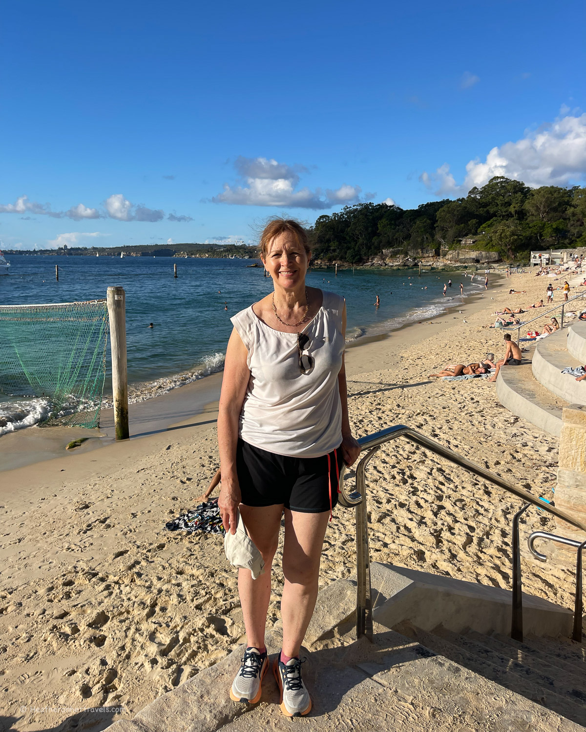
Nearby Shark beach is popular for swimming, with a cafe and changing facilities. Don’t be put off by the name, as the beach is netted and is backed by the large wooded space of Nielsen Park.
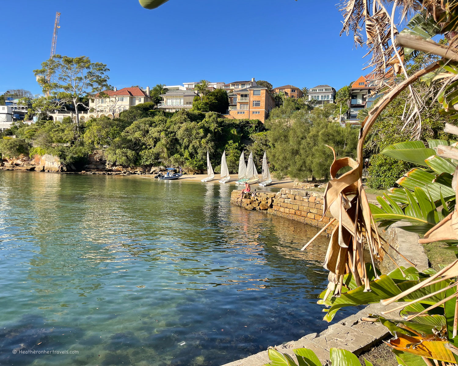
Hermitage foreshore – the next part of the walk was my favourites, along a wooded path in front of the rocky shore, with distant views of the Sydney Harbour Bridge.
The Hermitage foreshore walk passes a number of lovely secluded beaches, such as Milk beach, Hermit beach and Queens Beach. Historic Strickland House sits above the beaches, formerly a private mansion and then a convalescence hospital.
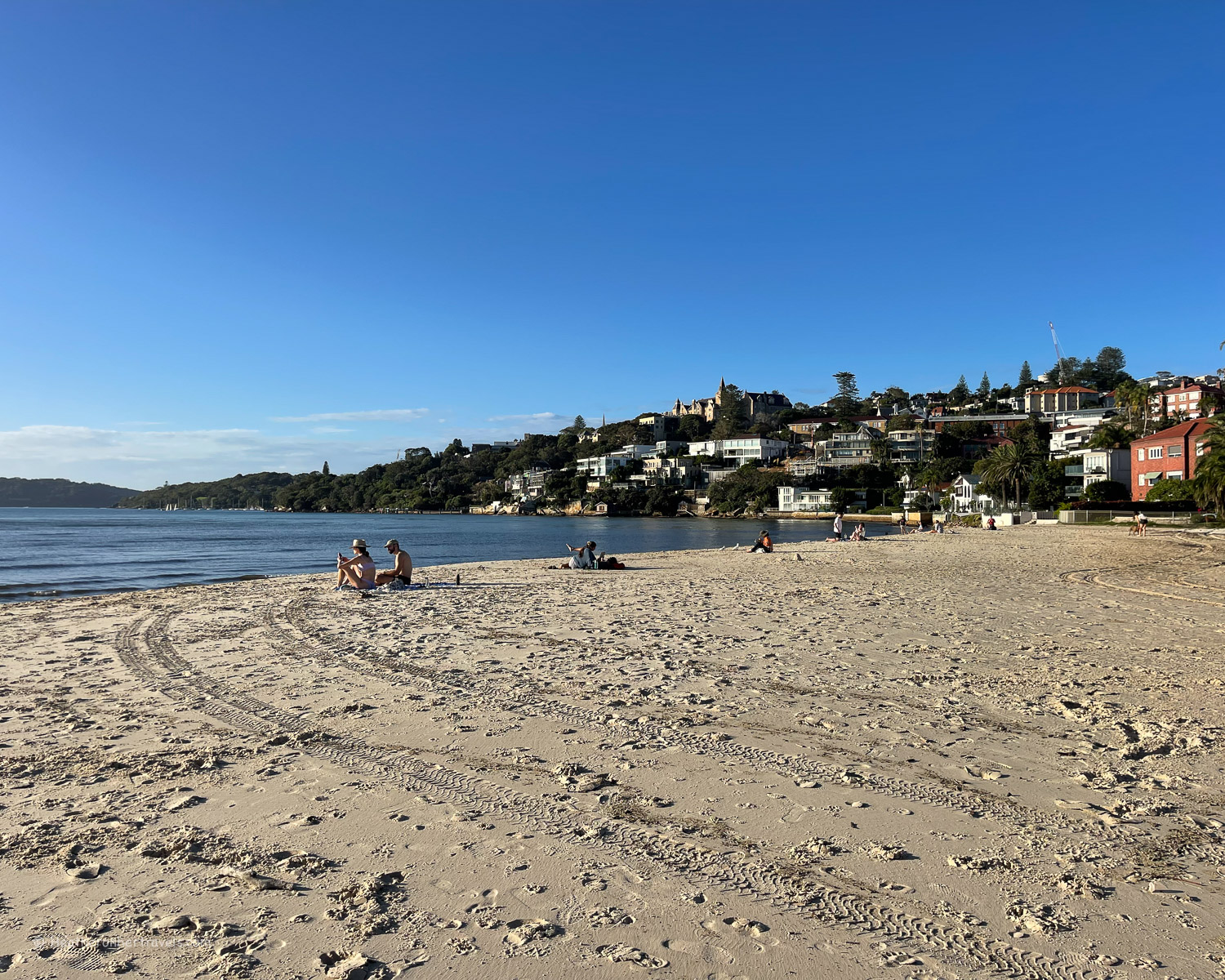
Rose Bay – at the end of the Hermitage Foreshore Reserve, the final stretch of the walk is along residential roads, bringing you down onto Rose Bay Beach.
This popular residential area of Sydney has shops and cafes, and at the end of the beach you’ll find the ferry wharf, to return to Circular Quay. Keep an eye out for the seaplanes that also take off from this spot, giving sightseeing tours from the air.
Planning – Watsons Bay to Rose Bay
- Most people will walk from Watsons Bay to Rose Bay.
- This could be combined with the Watsons Bay headland walk, also covered in this article.
- The walk takes around 3 hrs – but allow extra for photo, refreshment and swim stops.
- Distance around 8 km one way
- Recommended Cafes on the walk: Baithouse Watsons Bay, The Nielsen Shark Beach, Collins Lane Cafe Rose Bay.
Map – Watsons Bay to Rose Bay
Access the route map for the Watsons Bay to Rose Bay walk here or click on image below
Transport – Watsons Bay to Rose Bay
Ferry: From Circular Quay take the ferry to Watsons Bay Quay (every 30 mins). Less frequent ferries (every hour) also run from Manly Quay to Watsons Bay (Captain Cook Ferries). From Rose Bay take the ferry to return to Circular Quay (every 30 mins)
Bus: From Bondi Junction bus 380 to Watsons Bay. From Rose Bay bus 324 to Hyde Park or bus 325 to Town Hall in Central Sydney
Taxi: If you wish to break the walk at any of the beaches between Watsons Bay and Rose Bay, you may need to call a taxi as these are mainly residential areas.
Accommodation options
Your main accommodation options are:
- Stay in central Sydney and take the easy ferry from Circular Quay to Watsons Bay or Rose Bay
- Stay in Watsons Bay – we recommend the boutique Watsons Bay Hotel
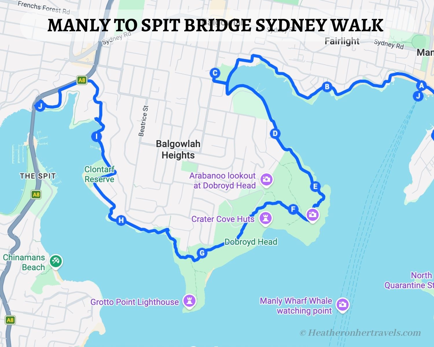
3. Manly to Spit Bridge
This walk is a local’s favourite among the Sydney coastal walks, taking in some pretty harbour beaches and inlets, combined with bush tracks and stunning views from the headland. You’ll start at Manly Wharf, which is easy to reach by ferry from Circular Quay.
The walk skirts the northern shore of the harbour with plenty of beach swimming opportunities, before climbing up onto the Dobroyd headland with views of yachts and ferries crossing the harbour.
Finally you’ll follow the cliffs through woodland past some idyllic secluded beaches, before descending to Clontarf Beach with its popular cafes and marina.
Highlights – Manly to Spit Bridge
The ferry to Manly Wharf – the Sydney Harbour ferry from Circular Quay to Manly is a highlight in itself, with views of the harbour, bridge and iconic Sydney Opera House.
Fairlight Beach – on the west side of Manly beach, pass the Manly Pavilion and follow the Fairlight Walk along the shore. You’ll pass Delwood Beach with its rocky outcrops, but Fairlight Beach offers easier swimming, with a sandy beach, reefs that are fun to swim around and a seawater swimming pool.

North Harbour Reserve – the path brings you to this grassy park, overlooking a small marina with sailing boats. It’s not a place for swimming, but with the Forty Beans cafe nearby this is a good place for refreshments and to pick up water if you need it. After this there are no cafes until the end of the walk.
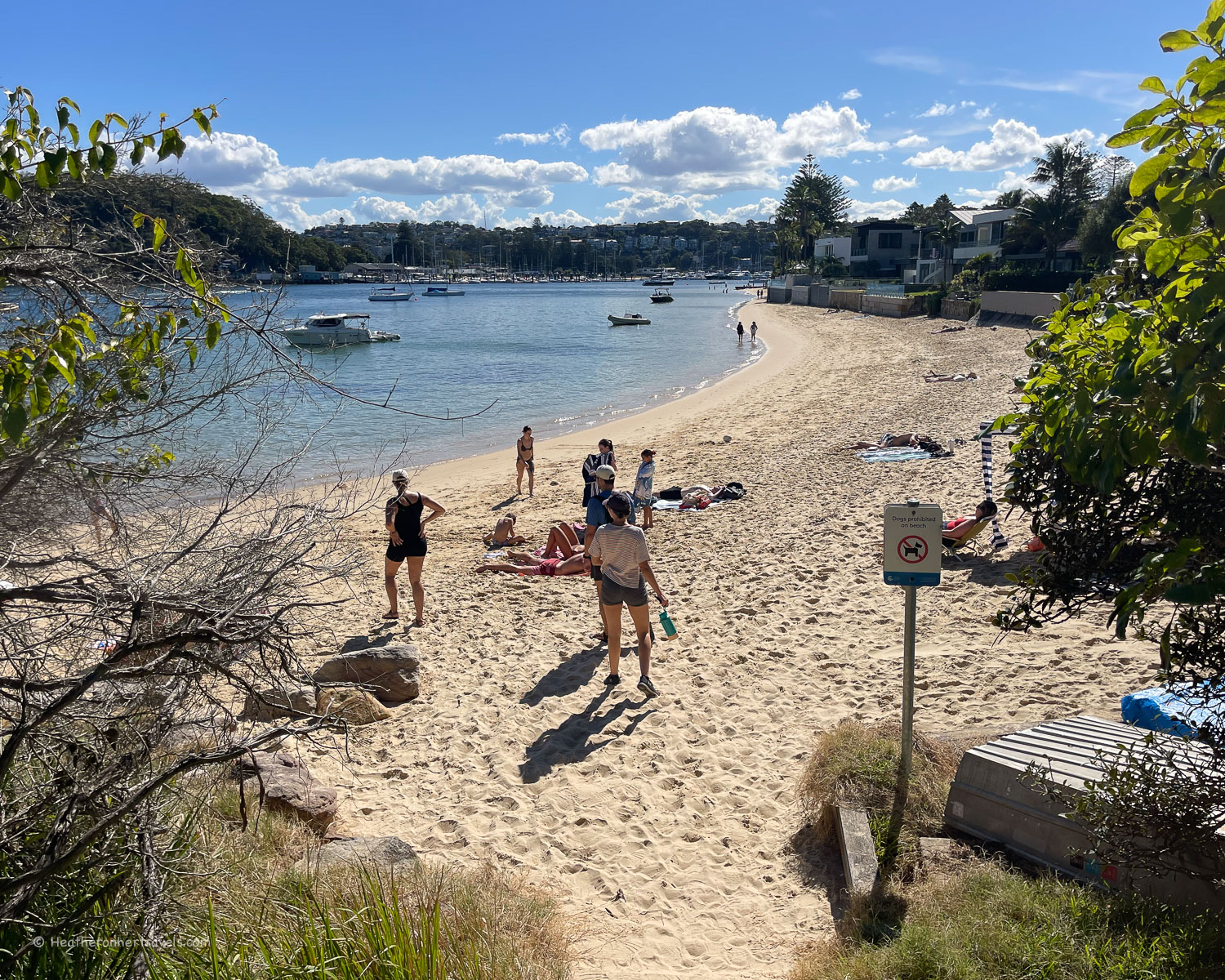
Reef beach – the path continues through a wooded shore passing idyllic beaches like this which is lovely for swimming, with a sandy centre and some interesting rocky reefs on either side.
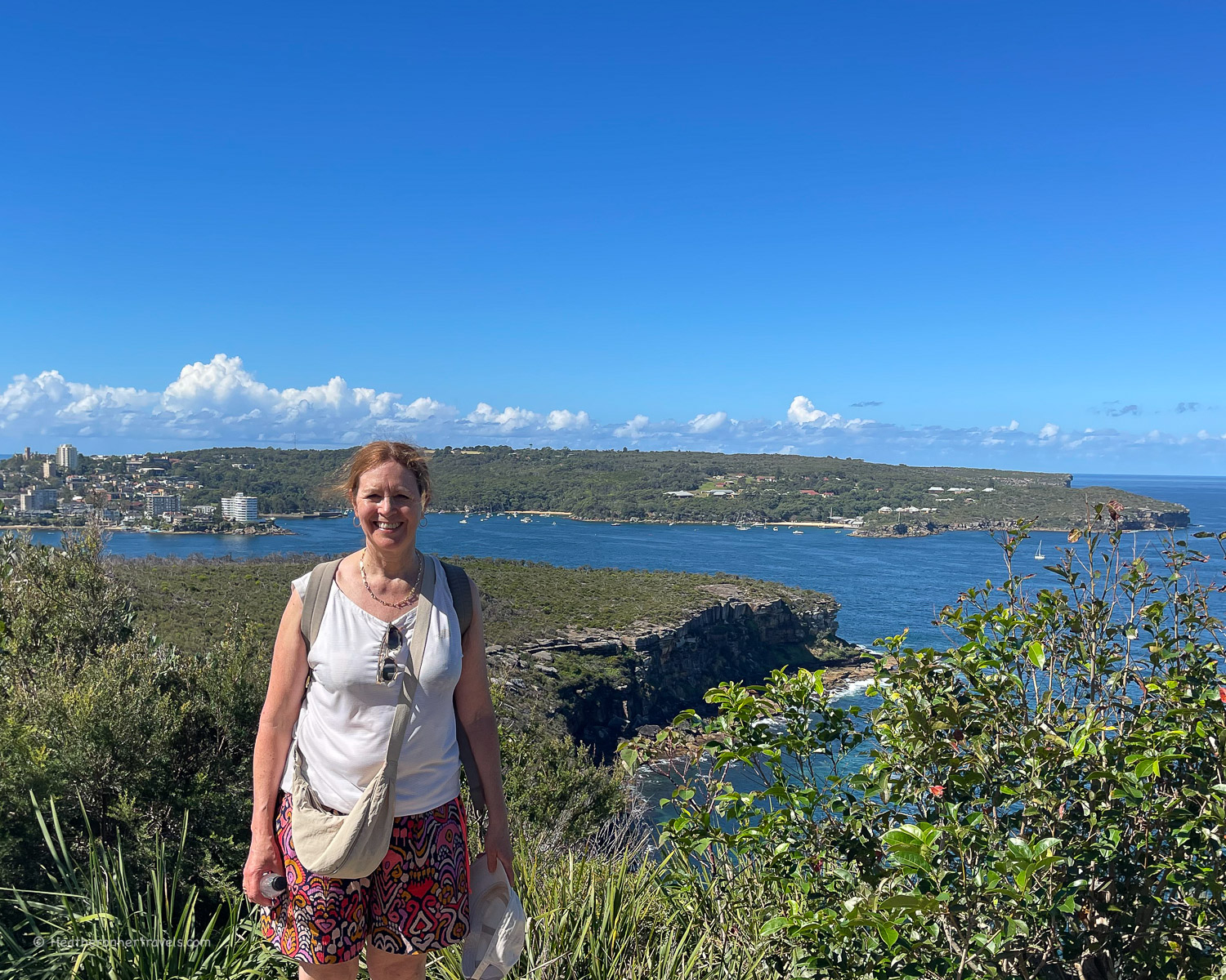
Dobroyd headland and the Fairlight lookout – as the path climbs up onto the headland, the path tracks through the bush with boardwalks in places. The views from this protected clifftop are beautiful, with a couple of lookout points for photos.
Castle Rock Beach – following steps the path descends from the headland through woodland, with tantalising glimpses of a couple of secluded beaches – Castle Rock and Isoldes, where you can walk down to swim. Look out for the lizards that bask beside the path.
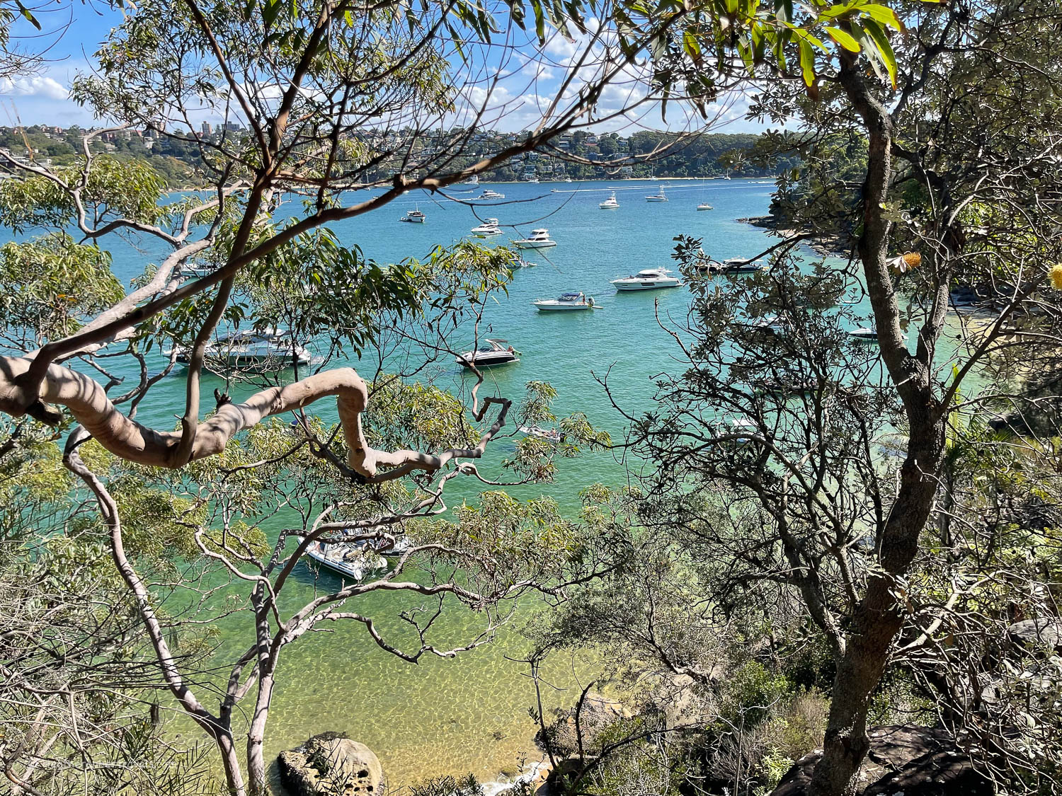
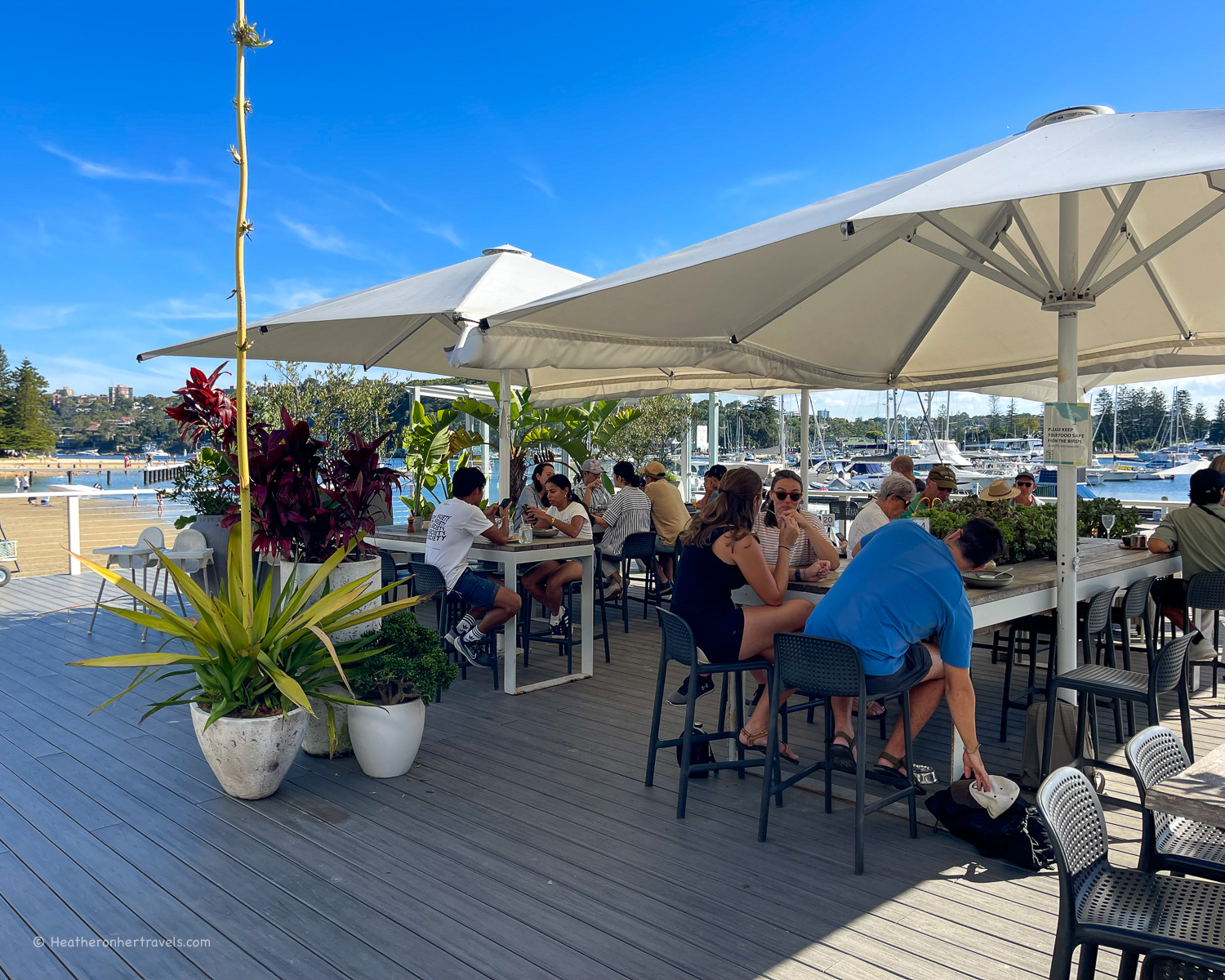
Clontarf Beach and Marina – finally you emerge to the more busy Clontarf Beach, leading to a marina that’s a popular sailing spot by Spit Bridge. The Sandy Bar Cafe is a great spot to relax at the end of the walk.
Planning – Manly to Spit Bridge
- Most people walk this route starting at Manly, which is easy to access by ferry, and end at Spit bridge, taking a bus or taxi back to town.
- This walk takes around 3-4 hrs – but allow extra for photo, refreshment and swim stops.
- Distance around 10 km one way
- Recommended Cafes on the walk: Forty Beans at North Harbour Reserve, Sandy Bar Cafe at Clontarf Marina.
Map – Manly to Spit Bridge
Access the route map for the Manly to Spit Bridge walk here or click on image below
Transport – Manly to Spit Bridge
Manly: Ferry from Circular Quay to Manly Wharf – runs around every 15 mins, journey time 30 mins
Spit Bridge: Bus 172X or 173X from south side of Spit Bridge to Wynyard Station in Central Sydney
Accommodation options
Your main accommodation options are:
- Stay in central Sydney and take the easy ferry to Manly. We recommend Pier One Sydney Harbour (mid range) A by Adina (boutique) or Ibis Sydney Barangaroo (budget), all of which are well located for sightseeing.
- Stay in Manly – we recommend checking some of the apartments close to the beach, or for a luxurious boutique hotel try Manly Pacific Sydney McGallery Collection.
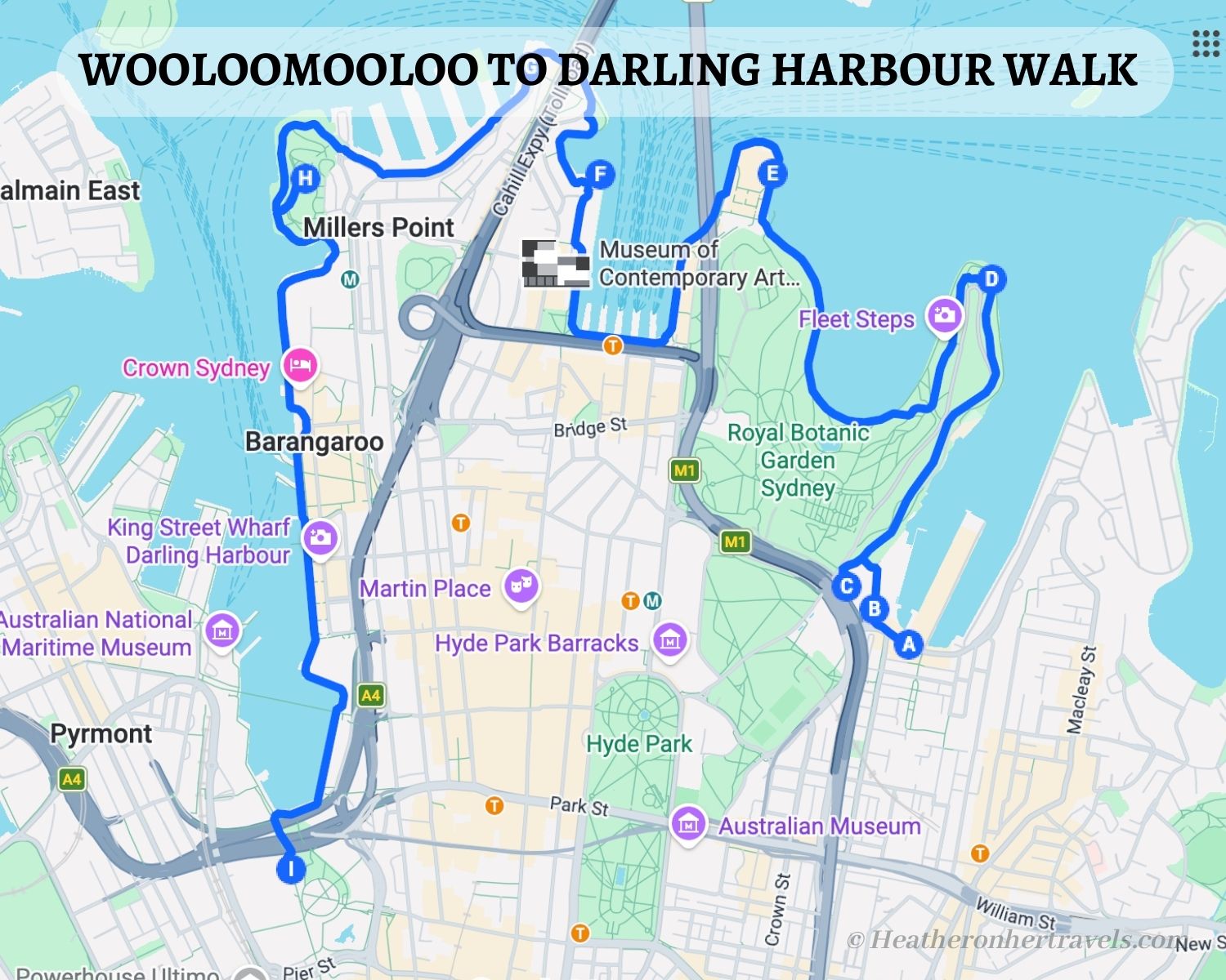
4. Wooloomooloo to Darling harbour
This walk is a good way of linking a number of Sydney’s highlights, such as the Art Gallery of New South Wales, Botanical Gardens, Sydney Opera House and Harbour Bridge.
Without stops the walk takes around 2 hours, but if you’re new to Sydney it would be a shame not to explore these Sydney landmarks, in which case the walk could take up to a day.
After the Harbour Bridge, the walk passes some historic piers, continues through the Barangaroo Reserve and ends in Darling Harbour, an area of re-development with new hotels, restaurants and entertainment activities.
Highlights – Wooloomooloo to Darling harbour
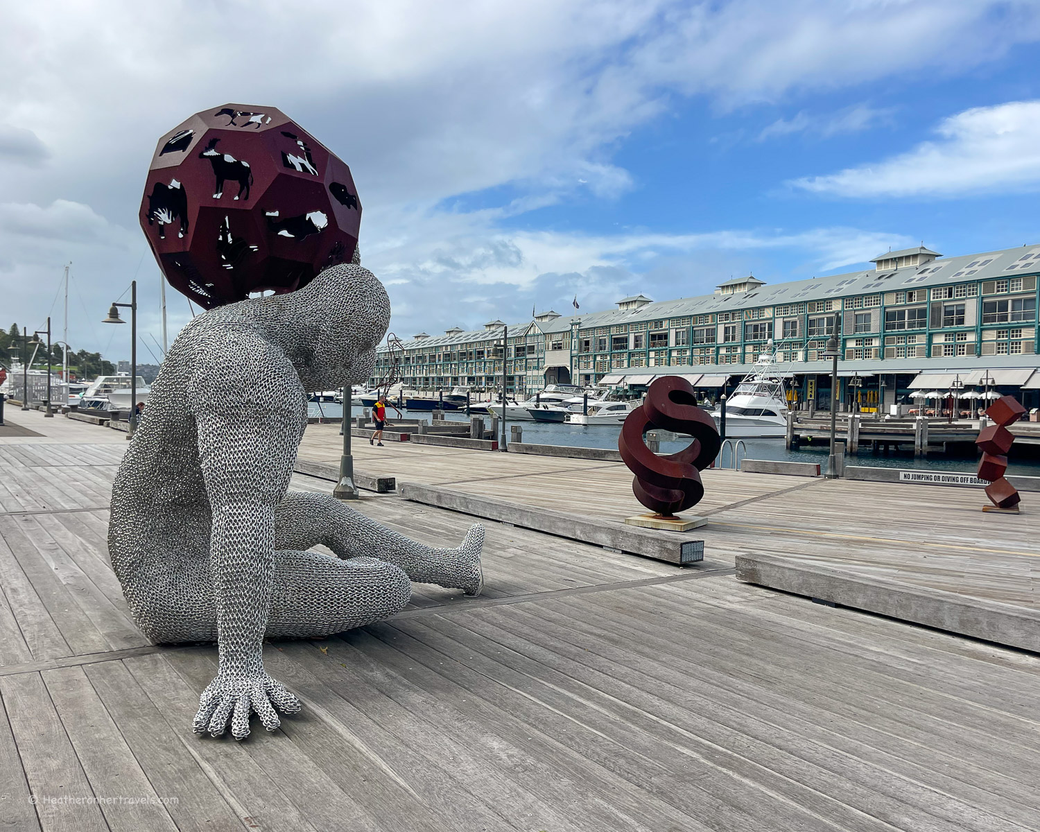
Finger Wharf – We recommend starting the walk at Finger Wharf, which comes alive with upscale restaurants at night. The boardwalk and marina in front of the Wharf terraces are a pleasant place to stroll, with a collection of public sculptures.
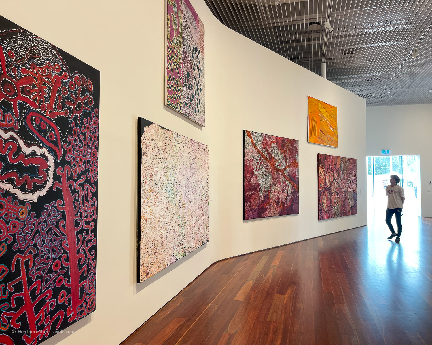
Art Gallery of New South Wales – from the boardwalk, climb behind the Wharf terraces through the landscaped gardens, passing the Woolloomooloo lookout. If you have time to stop, we highly recommend looking in the new glass wing of the art gallery (free), with the Naala Badu gallery of Aboriginal art.
Royal Botanical Garden – walking along Mrs Macquarie’s Rd you’ll get views from the lawned slopes towards Potts Point and its Naval Base. Mrs Macquarie’s Chair is a stone bench carved for the governor’s wife, a well known landmark and a good spot to view the Sydney Opera House.
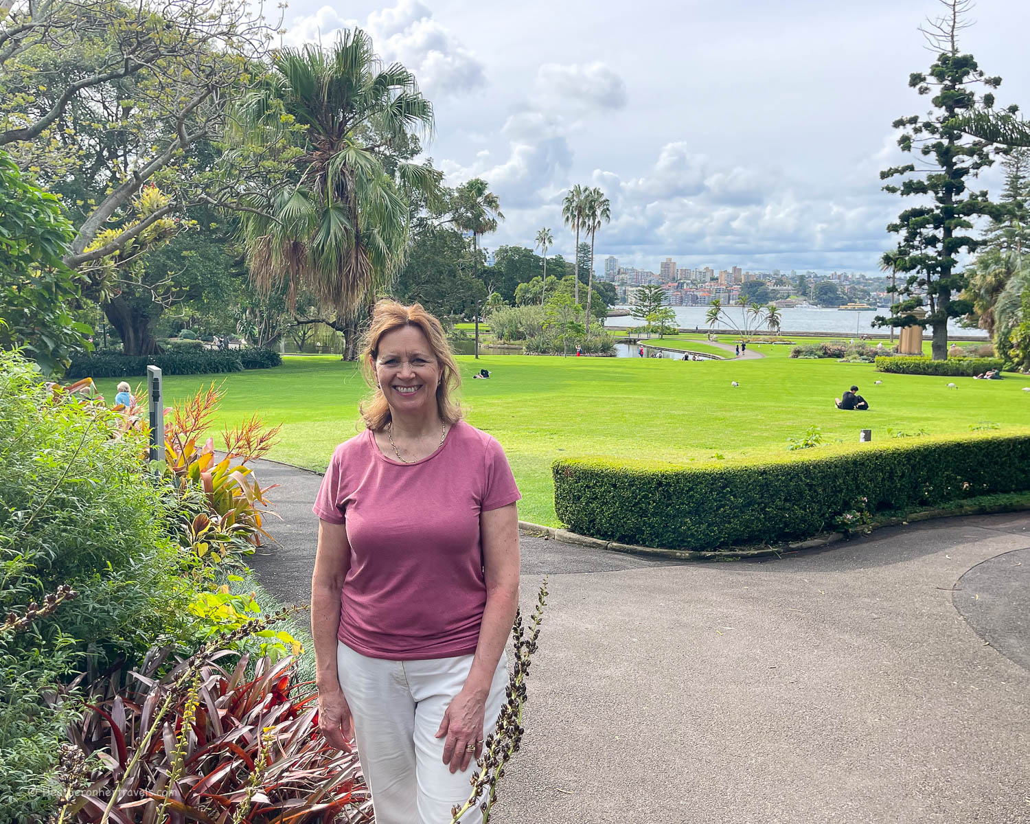
The path then skirts Farm Cove and the edge of the Royal Botanical Garden, with plenty to see in these wonderful free gardens, if you have time to explore further.

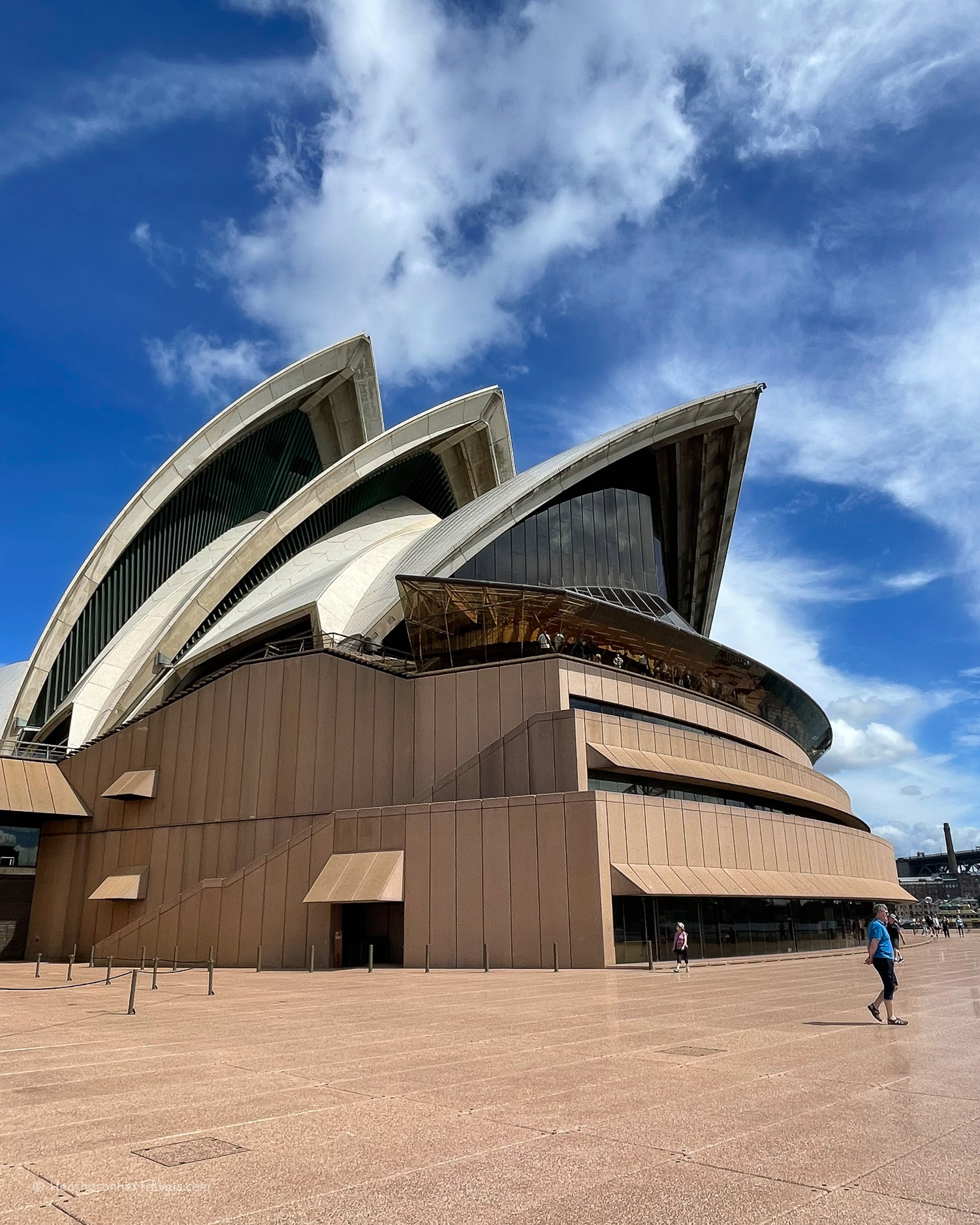
Sydney Opera House – the path brings you next to the famous Sydney Opera House, completed in the 1970s. You should allocate some time to view the opera house from all sides and levels, as well as a glimpse of the interiors that you get from the ticket office.
Circular Quay – from the Opera Bar there’s a great viewpoint of the Harbour Bridge, and the architectural towers of the Central Business District (CBD). Walk along the boulevard towards the bustling quays where the ferries come and go, used by commuters and tourists alike.
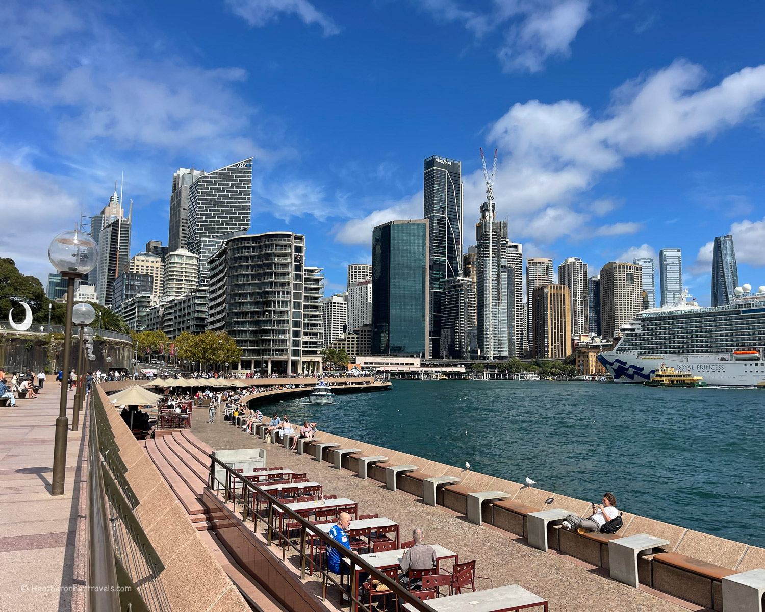
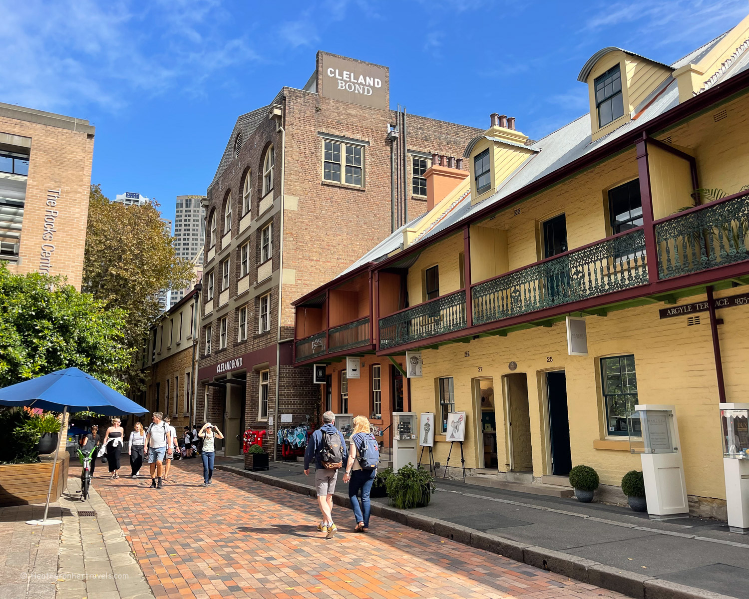
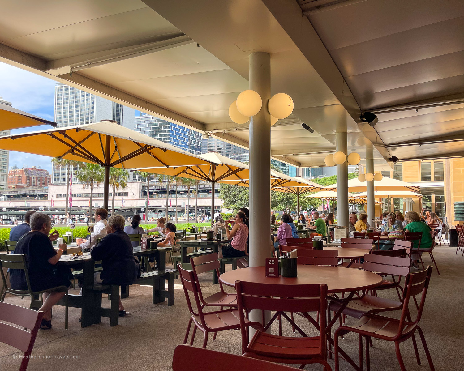
The Rocks – continue past the Museum of Contemporary Art ( with excellent ground floor cafe), stopping for a quick look at Cadman’s Cottage and Campbell’s Stores.
These historic warehouses date back to the 1850s when this was a bustling wharf. The Rocks neighbourhood is the oldest part of the colony, with cottages and cobbled streets that are now home to tourist shops and restaurants. Take a detour to explore if you have time.
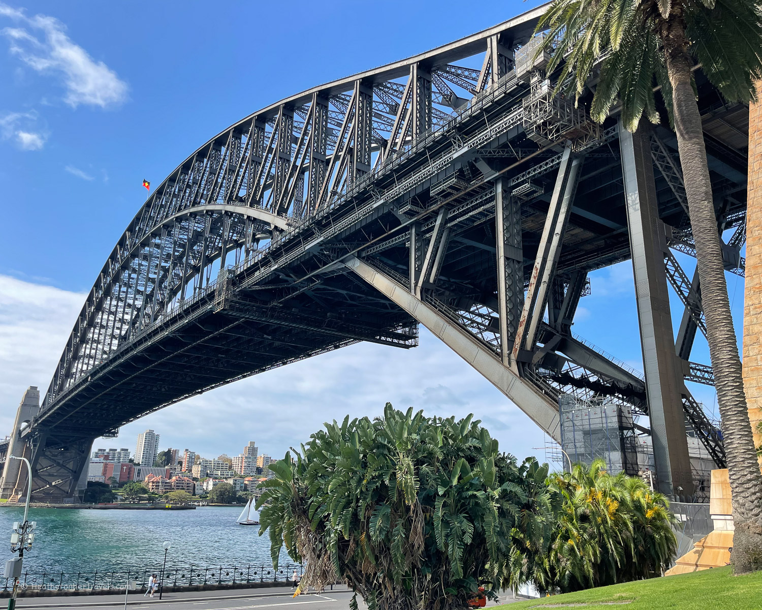
Sydney Harbour Bridge – continue along Hickson Rd to the Dawes Point Battery, under the shadow of the Harbour Bridge. On this grassy area there’s information about the original battery that stood here to guard the harbour and the building of the bridge.
This walk takes you underneath the bridge, but it’s worth walking along it another time for the views of the Sydney Opera House.
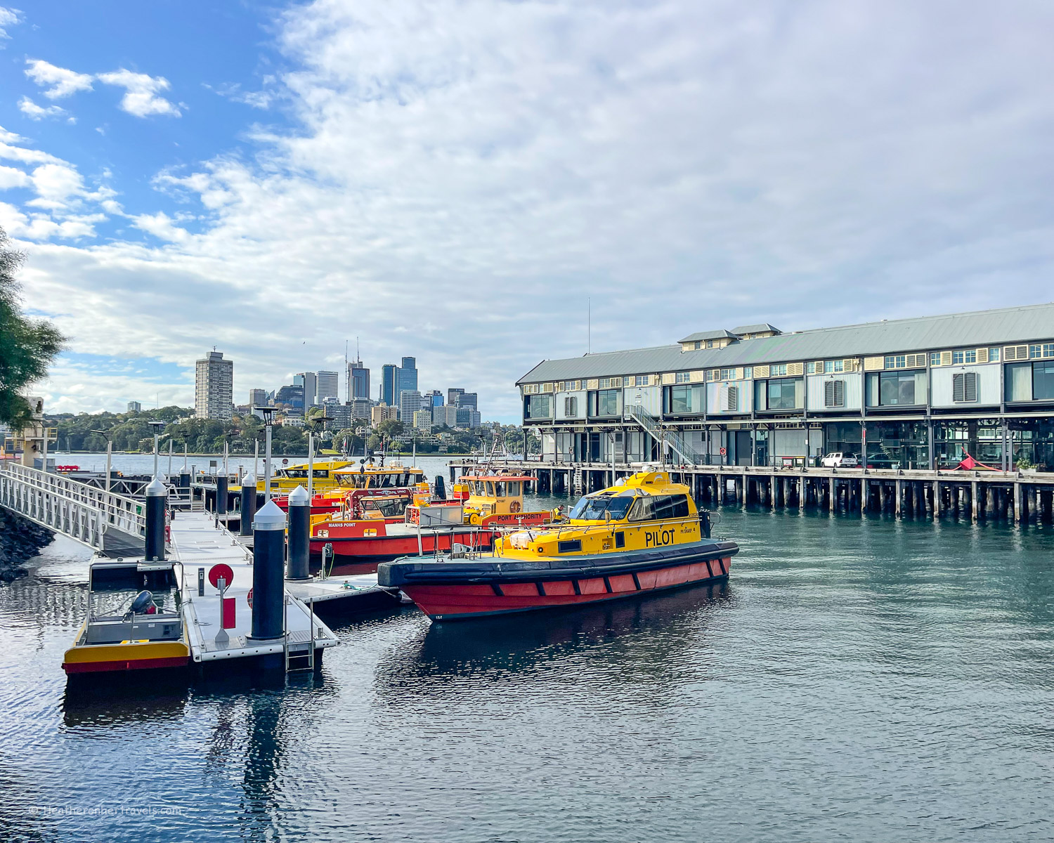
The Piers, Walsh Bay – continuing past the Pier One hotel you’ll pass a series of Piers in Walsh Bay. These were formerly used to load bales of wool onto ships for export around the world, but have now been converted for apartments, restaurants and a home for the Sydney Dance and Theatre companies.
Observatory Hill – located between the piers and the harbour bridge, you may notice Observatory Hill and the dome of the Sydney Observatory. It’s worth making a detour if you have time to see the observatory and take in the harbour views from the grassy park on top of the hill.
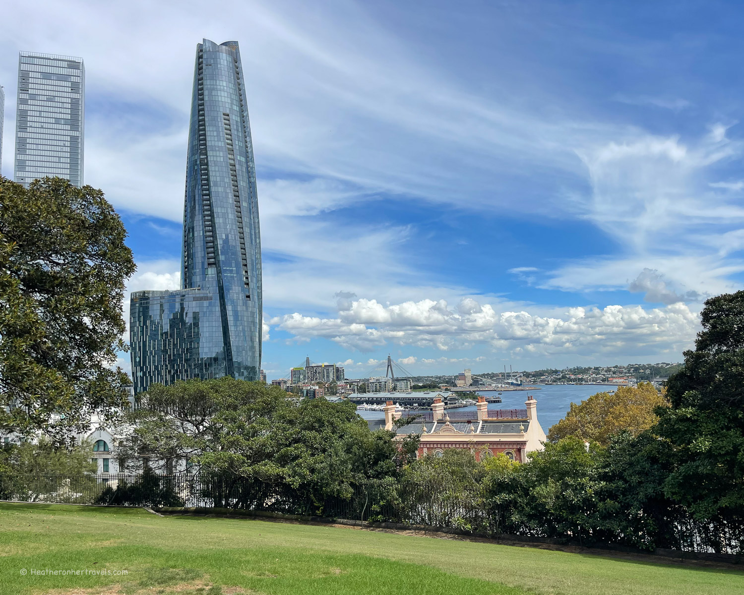
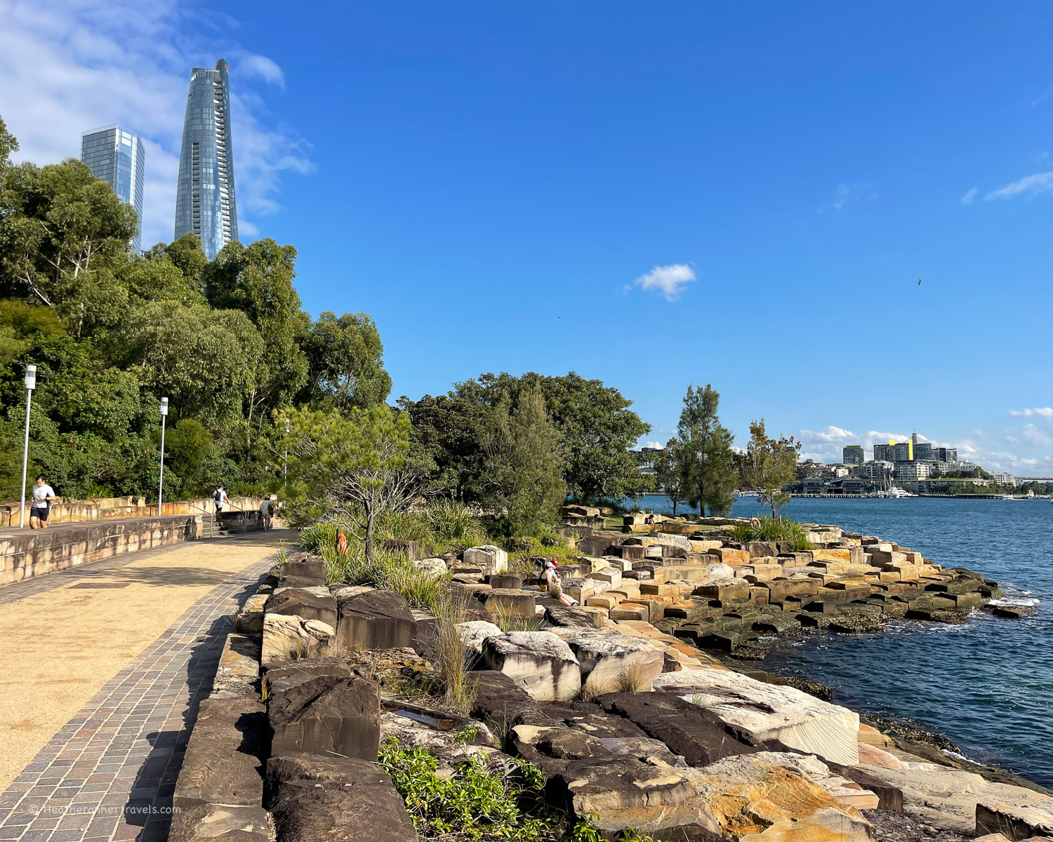
Barangaroo Reserve – beyond the Piers, the path leads into the public park of Barangaroo Reserve. The former disused container storage site has been planted with grassy lawns and native species, with blocks of local rock to make the foreshore beside the harbour. As you follow the path beside the water, Darling Harbour and its high rise office buildings come into view.
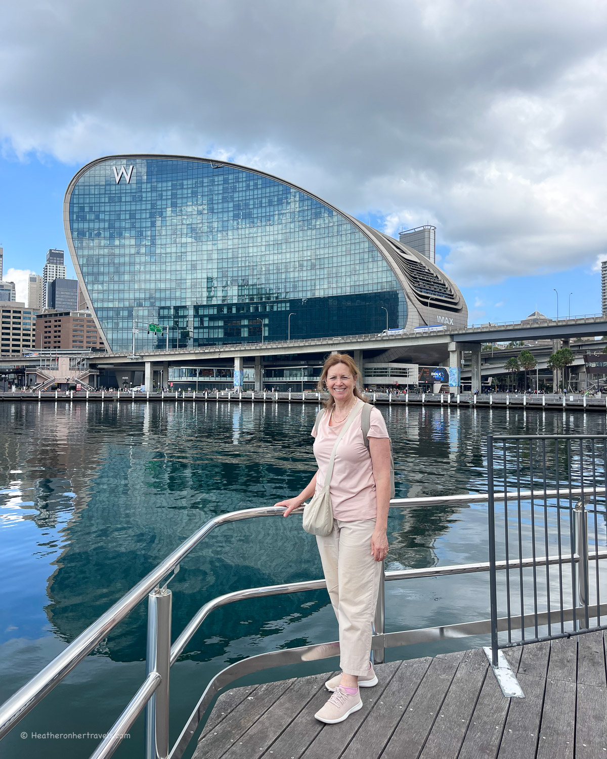
Darling Harbour – this area was originally Sydney’s major industrial port, but was redeveloped by the 1980s into a leisure and entertainment district. There are modern apartment and office blocks here, as well as the Australian Maritime Museum and entertainment venues like SEA Life aquarium.
This is where the walk ends and you can return by ferry to Circular Quay from both Banangaroo Wharf and Pyrmont Bay Wharf, on either side of the harbour.
Planning – Wooloomaloo to Darling harbour
- We recommend starting at Wooloomooloo Finger Wharf, as return transport options are easier from Darling Harbour. This walk passes through Circular Quay, so you could also just walk from there in either direction.
- The walk takes around 2 hrs – but allow extra for photo and refreshment stops. As it passes some of Sydney’s best known landmarks, it could easily take a half day to full day.
- Distance around 6 km one way
- Recommended Cafes on the walk: Sydney Botanic Gardens Cafe, Museum of Contemporary Art Cafe (The Rocks), Zupano Expresso Bar (Piers at Walsh Bay), Brazico Brazilian Churrasco (Darling Harbour).
Map – Wooloomooloo to Darling harbour
Access the route map for the Wooloomooloo to Darling Harbour walk here or click on image below
Transport – Wooloomooloo to Darling harbour
Finger Wharf, Wooloomooloo: Closest train station Kings Cross (15 mins walk) or call an Uber to drop / pick up at Finger Wharf
Darling Harbour: Ferries run from Banangaroo Wharf and Pyrmont Bay Wharf to Circular Quay
Accommodation options
Darling Harbour is a good place to base yourself while visiting Sydney, as there are several modern hotels and it’s generally a little cheaper than the CBD or Rocks areas of Sydney. Try the Ibis Sydney Barangaroo, which is well located for sightseeing.
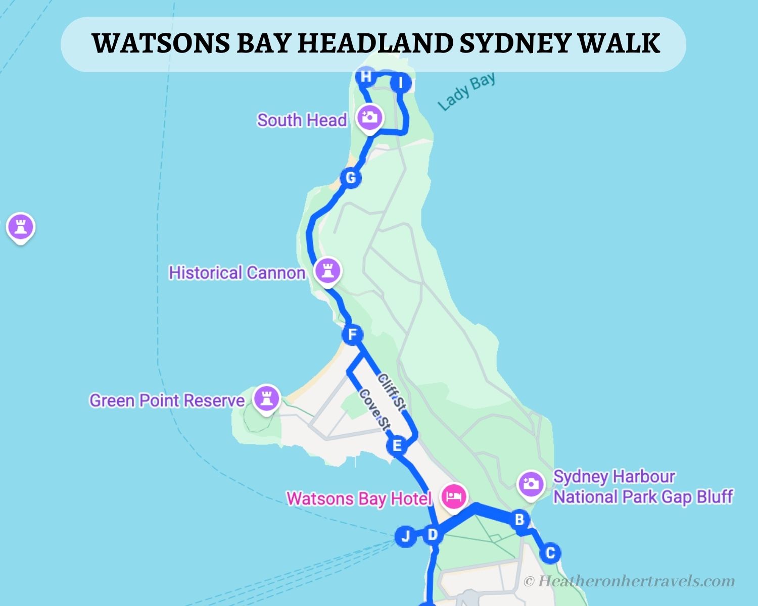
5. Watsons Bay Headland
This short walk takes you from Watsons Bay wharf, around the headland of South Head, at the mouth of Sydney Harbour. There are a couple of protected harbour beaches, and you can also climb up on the cliffs to see the wilder ocean side of the headland.
Depending on how long you want to linger, the walk can be done in about an hour, and is a nice addition to the longer Watsons Bay to Rose Bay walk that’s also described in this article.
Highlights – Watsons Bay Headland
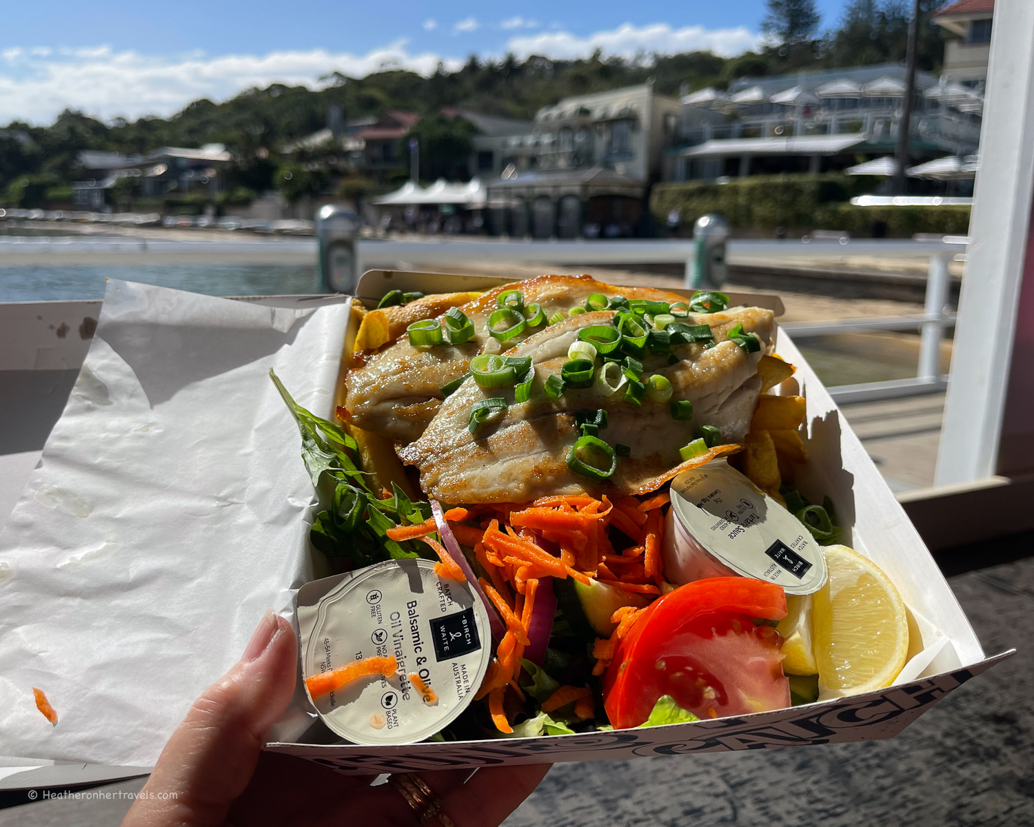
Watsons Bay with fish and chips at Doyles – This pretty and historic bay was used by the Aboriginal Cadigal group for fishing and gathering of shellfish. From 1790 the area was taken over by colonists as a signal station at the mouth of the harbour for ships arriving in Sydney.
Ferries arrive here from Circular Quay and it’s a bit of a tradition to order fish and chips at Doyle’s, either at the restaurant or the takeaway kiosk overlooking the ferry pier.
Gap Bluff – from the Watsons Bay ferry pier, take the path up through Robertson’s Park to the lookout that’s close to the bus stop. From here you get a view of the cliffs and crashing waves on the ocean side, making a contrast to the calmer waters of the harbour.
The clifftop path leads to an anchor taken from the ship Dunbar, commemorating its wreck in 1857 during a storm, with the tragic loss of 121 lives.
If you climb the steps and boardwalk in the other direction, you can explore the rocky Gap Bluff headland, although you’ll need to retrace your steps, as the route onto the headland is blocked by a large naval base.

Camp Cove – back at Watsons Bay pier, take the path in front Doyle’s restaurant down Cove St or Cliff St, admiring the pretty 19th century cottages. You’ll arrive at the scenic Camp Cove, with its popular kiosk cafe, known for freshly squeezed orange juice and smoothies.
It’s a lovely beach to relax and swim if not too busy. If the crowds on the beach are too much, you might prefer to continue to the more secluded Lady Bay Beach, which is favoured by naturists.

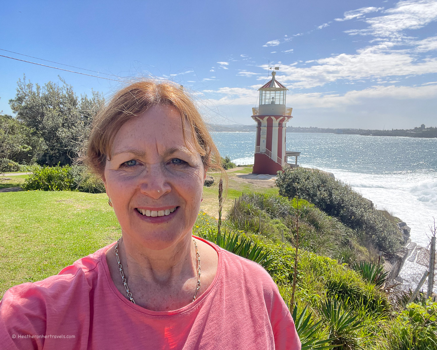
South Head and Hornby Lighthouse – The path beyond Camp Cove continues past some historic canon and up onto South Head, passing in front of the naval base. A little further, the headland opens up with lovely views across the mouth of the harbour.
There are some lightkeeper’s cottages cottages on the headland, built in the 1850s to serve the Hornby Lighthouse that signalled the mouth of the harbour. The path circles the end of the headland, before bringing you back to Camp Cove and the Watsons Bay Wharf.
Planning – Watsons Bay Headland
- The walk begins and ends at Watsons Bay
- This could be combined with the Watsons Bay to Rose Bay walk, also covered in this article.
- The walk takes around 1 hr – but allow extra for photo, refreshment and swim stops.
- Distance around 4km to make the loop and return to Watsons Bay Wharf
- Recommended Cafes on the walk: Baithouse Watsons Bay, Doyles on the Wharf (Takeaway fish & chips with seating), Camp Cove Kiosk.

Map – Watsons Bay Headland
Access the route map for the Watsons Bay Headland walk here or click on image below
Transport – Watsons Bay Headland
Ferry: From Circular Quay take the ferry to Watsons Bay Quay (every 30 mins). Less frequent ferries (every hour) also run from Manly Quay to Watsons Bay (Captain Cook Ferries).
Bus: From Bondi Junction bus 380 to Watsons Bay.
Accommodation options
Your main accommodation options are:
- Stay in central Sydney and take the easy ferry from Circular Quay to Watsons Bay or Rose Bay. We recommend Pier One Sydney Harbour (mid range) A by Adina (boutique) or Ibis Sydney Barangaroo (budget), all of which are well located for sightseeing.
- Stay in Watsons Bay – we recommend the boutique Watsons Bay Hotel
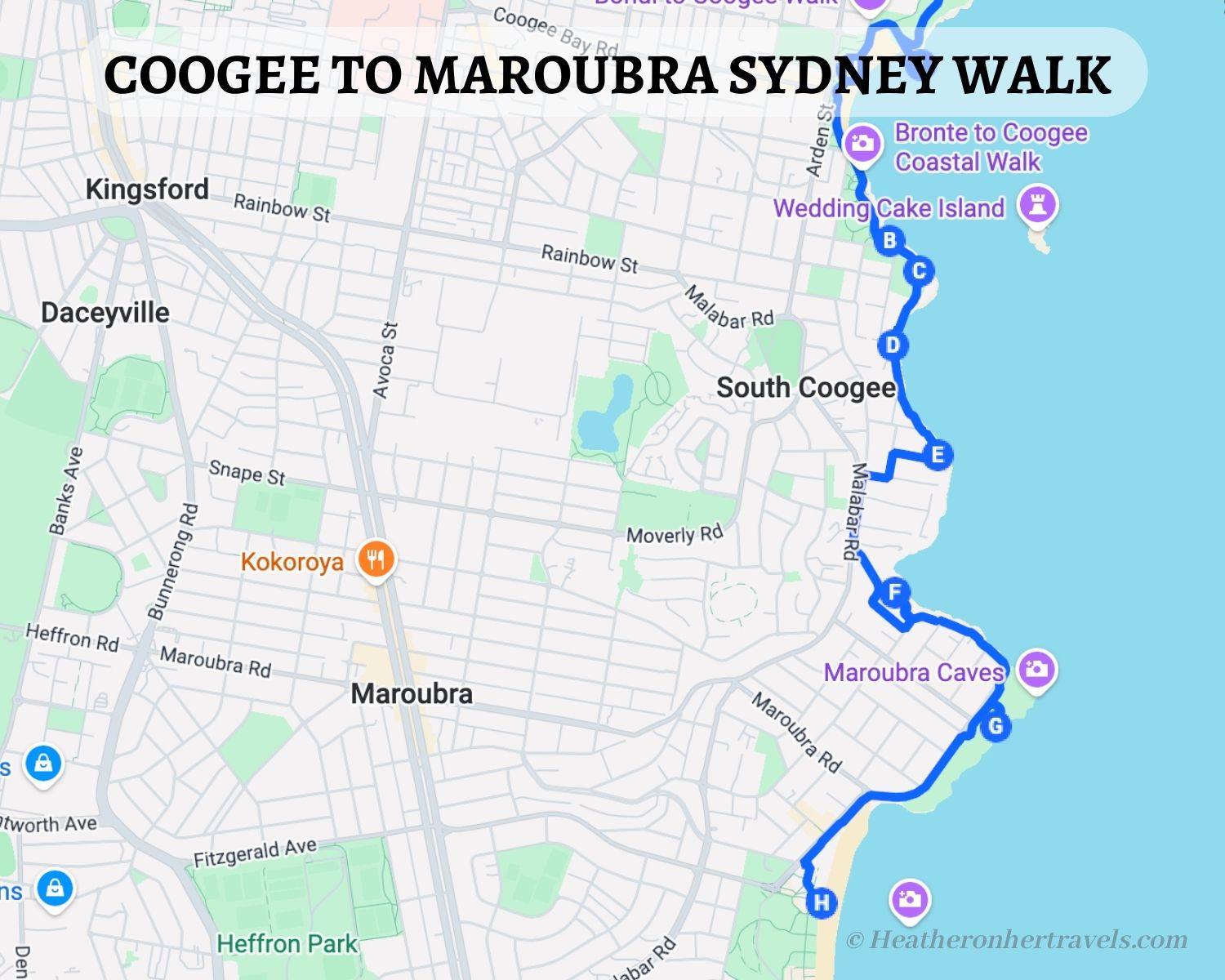
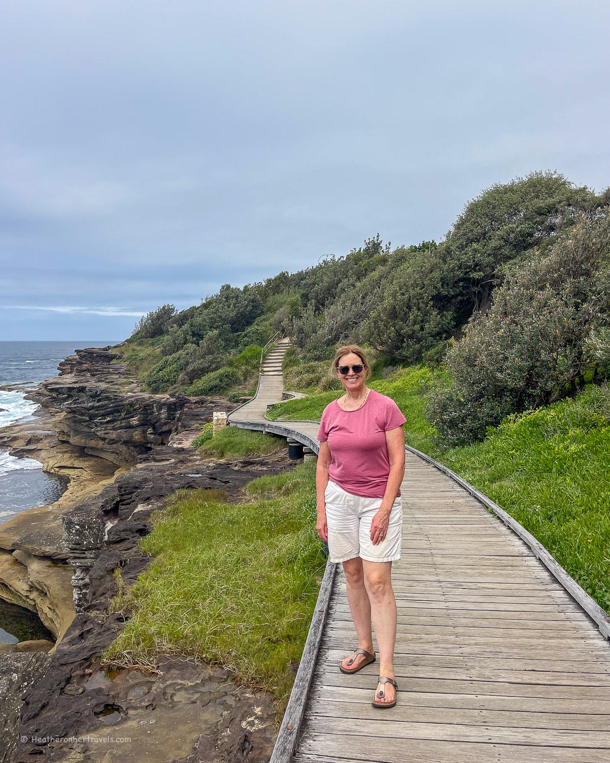
6. Coogee to Maroubra
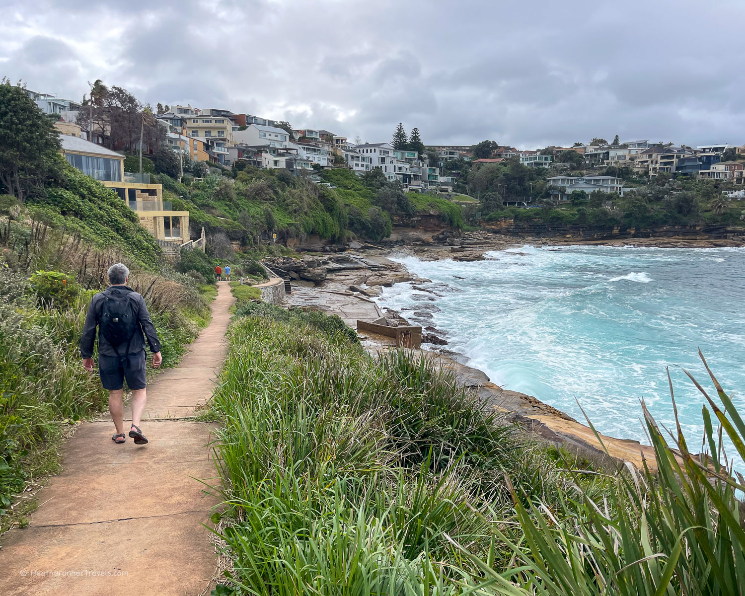
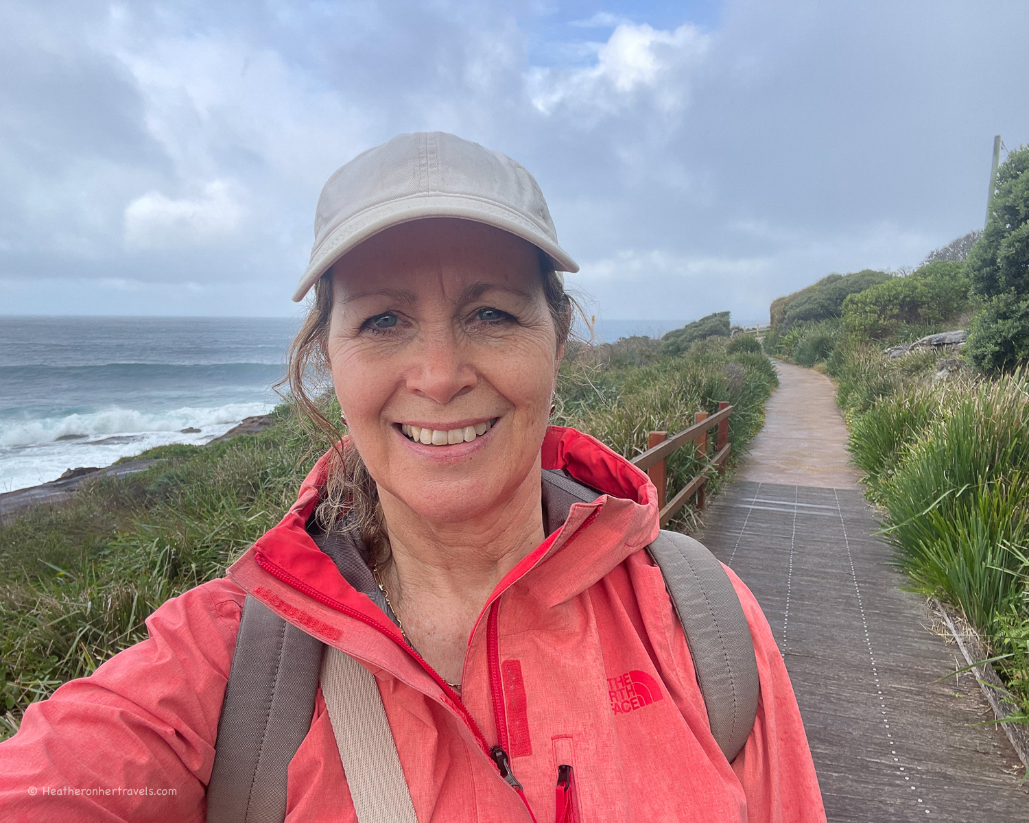
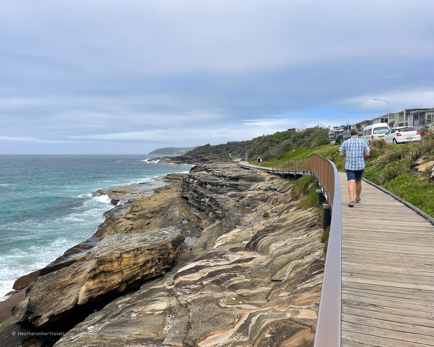
This walk is an extension of the better known Bondi to Coogee walk, as you continue south from Coogee to Maroubra beach. The path follows the rocky clifftop and passes through some wild coastal landscapes including the wetland habitat of Tennery peat swamp.
There are several lovely rockpools and bathing spots to try between the beaches of Coogee and Maroubra, but this walk is mostly about the clifftop and seascapes.
We walked from Maroubra to Coogee, so have described it in that order, but you could go in either direction.
Highlights – Maroubra to Coogee
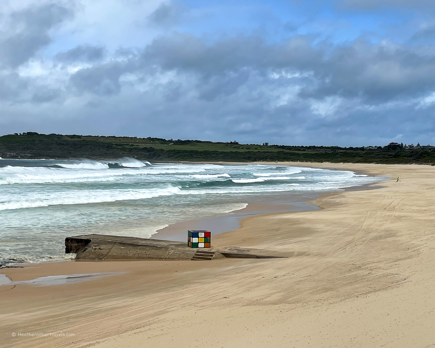
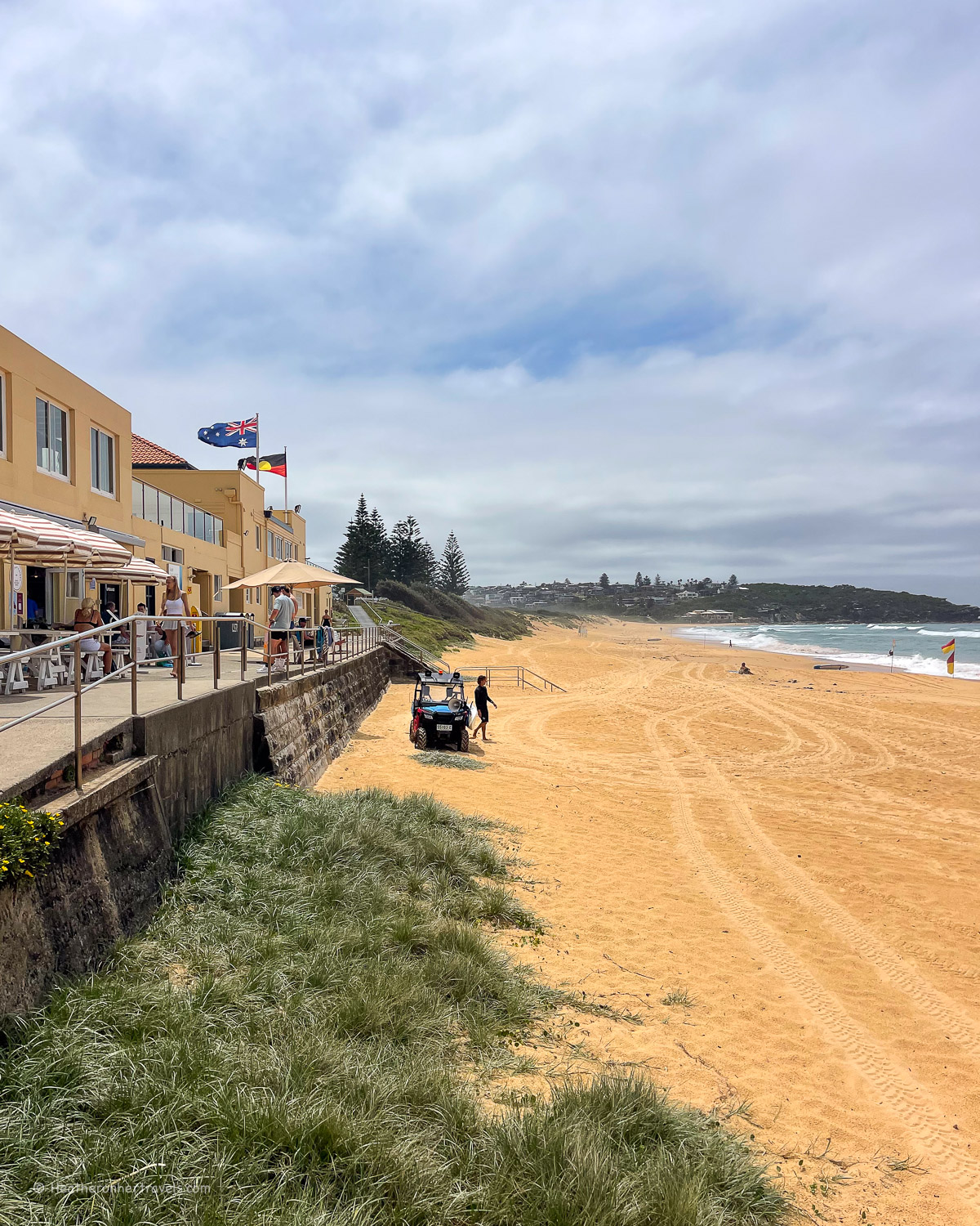
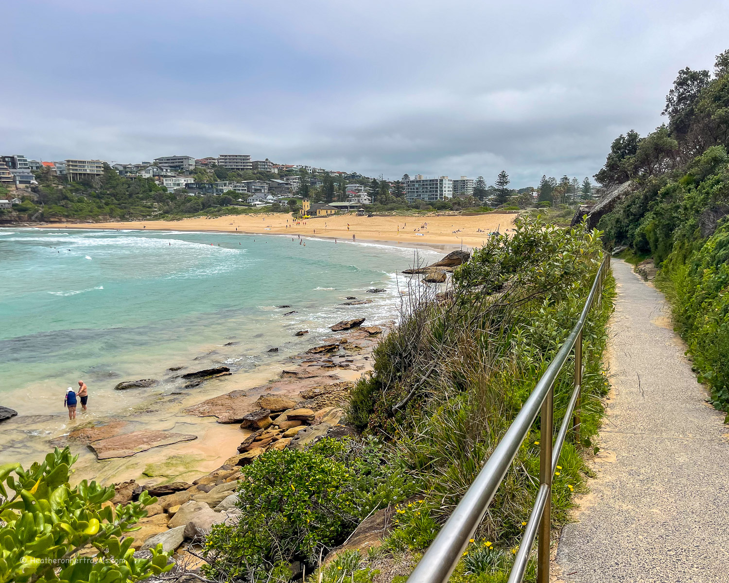
Maroubra beach – this long sweep of sand is very much a local’s beach and the rolling waves make it popular for surfing. We also saw families bodyboarding at the northern end, and there are some shops and cafes behind the beach.
You may spot the Maroubra ‘Rubik’s Cube’ on the beach, a concrete storm vent that was painted by street artists and has become a distinctive feature of the beach.
Malabar Headland – if you wish to extend the walk beyond Maroubra, continue southwards onto the Malabra Headland, following the coastal walk as far as Botany Bay.
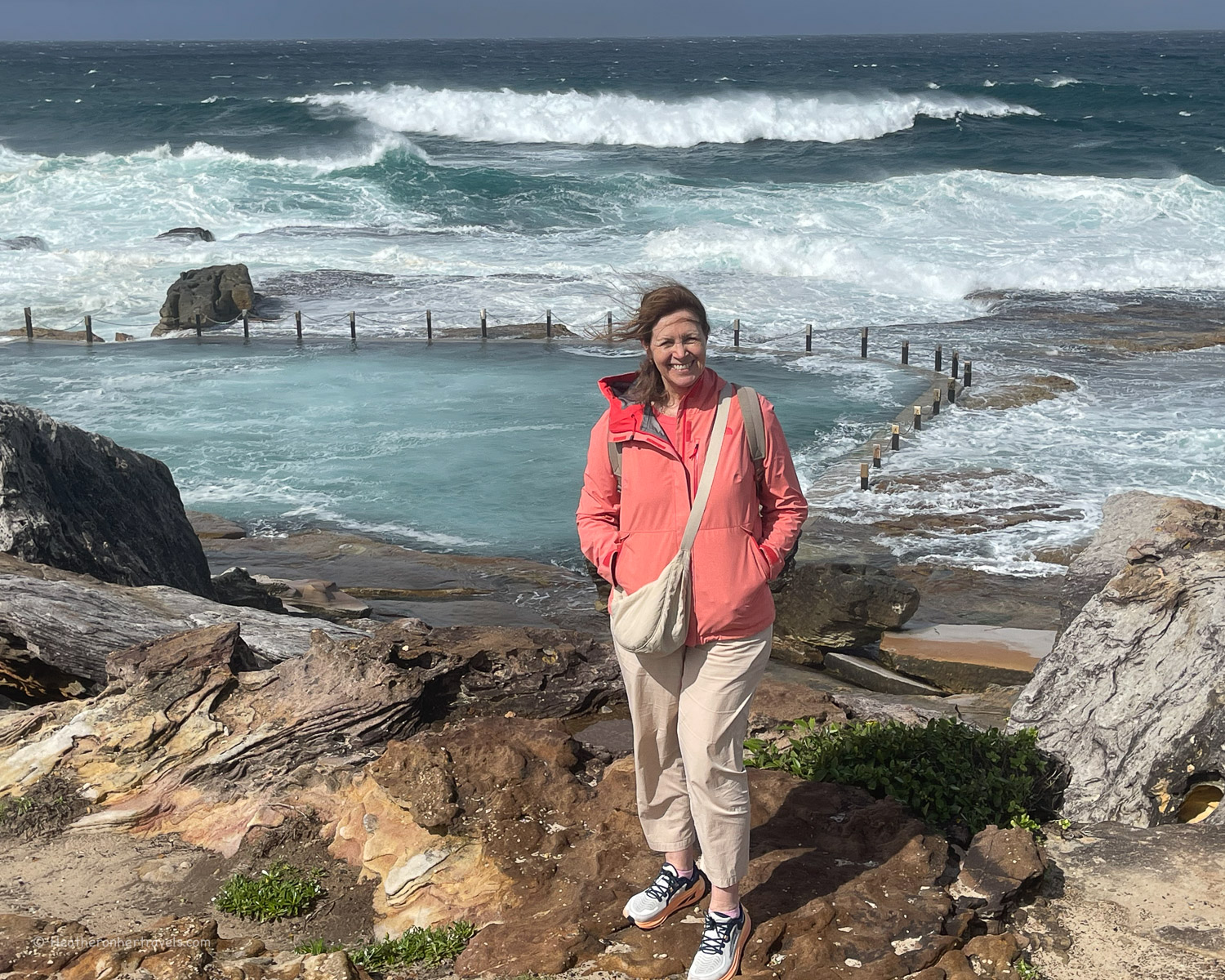
Mahon Pool – Just north of Maroubra Beach is the Jack Vanny Reserve, with the Mahon Rockpool, where you can swim close to the ocean, if the breakers are not too high (following storms it was quite rough on the day we visited!)
Lurline Bay and Rob Walker Rock Pool – This bay is covered with rocky reefs with a rock pool that can be used at low tide. The path leads across the rocks although at high tide or when the surf is high, you may need to take a detour behind the houses.
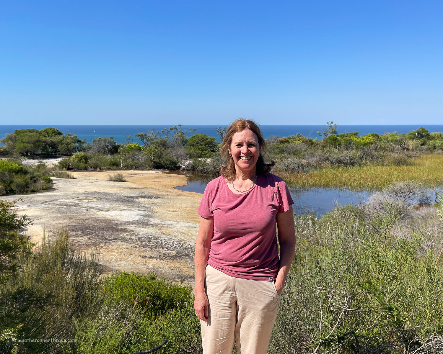
Trennery Reserve – before you descend to Cooggee, a boardwalk takes you across the Trennery Peat Swamp, a marshy habitat for wetland flora and fauna.
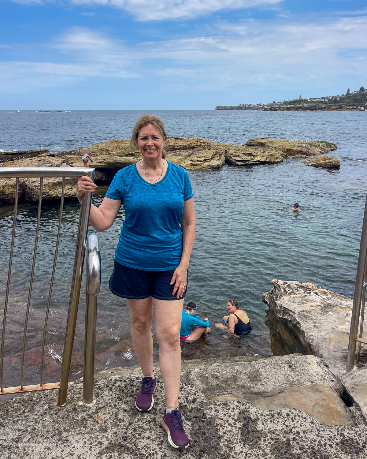
South Coogee seawater baths – on the approach to Cooggee are a couple of seawater pools, where you can pay to swim. Heritage listed Wylie’s Baths were opened in 1907, while McIver’s Ladies Baths offers secluded ladies only swimming.
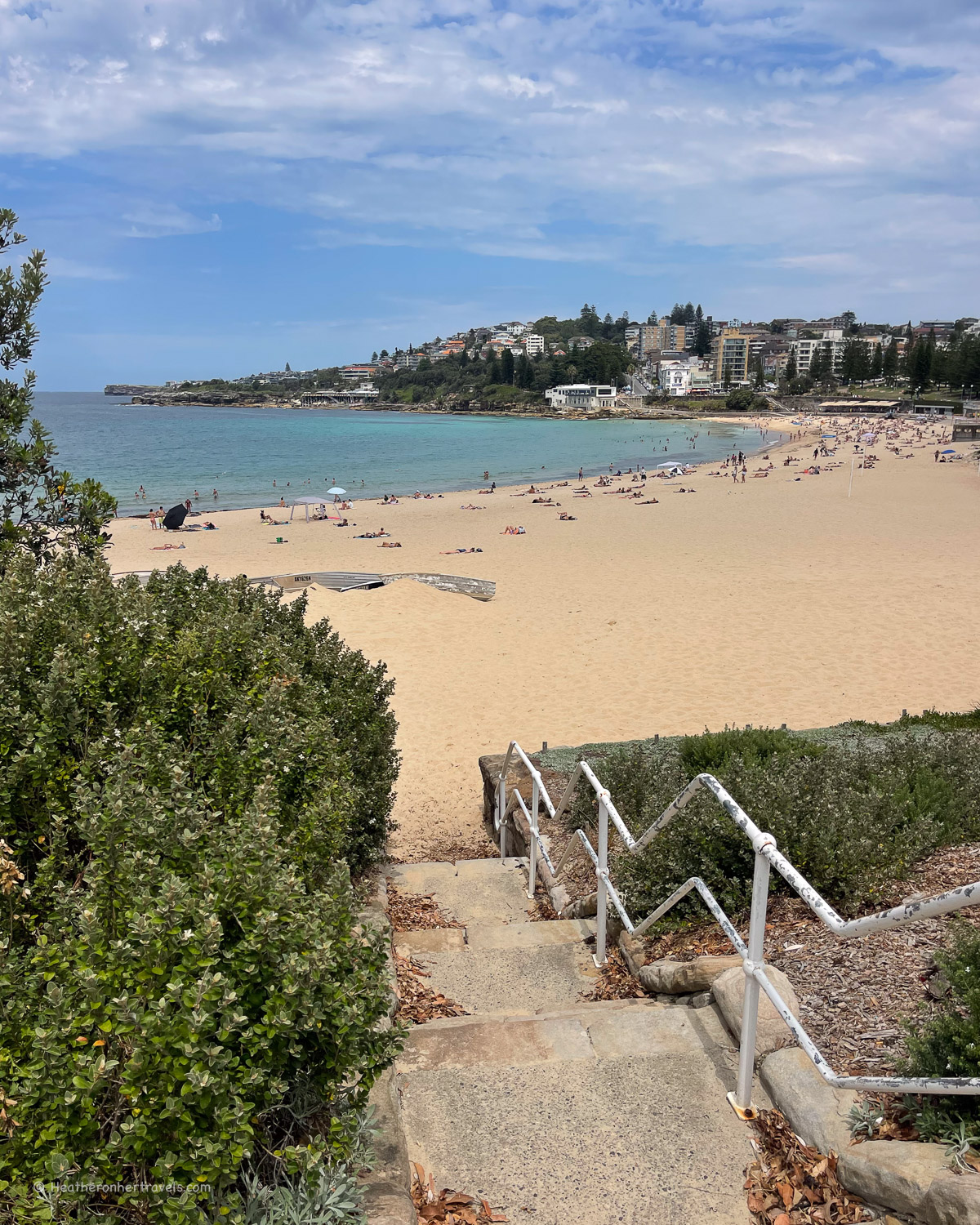
Coogee Beach – The long sweep of sand at Coogee is more protected than other nearby beaches, sheltered by Wedding Cake Island offshore. It’s a family friendly beach, bounded at either end by cafes and grassy banks for sunbathing. The Giles Bath tucked away at the northern end is a fun place to swim if you want a rockpool with some protection from the surf.
Planning – Maroubra to Coogee
- You can walk in either direction – we started at Maroubra and ended in Coogee.
- This walk takes around 1.5-2 hrs – but allow extra for photo, refreshment and swim stops.
- Distance around 5-6km one way
- The walk makes an extension to the popular Bondi to Coogee walk, also covered in this article.
- Recommended Cafes on the walk: Pavilion Beachfront Maroubra Beach (great for lunch), The Grumpy Baker Maroubra, Pool Coffee Eatery Maroubra, Bronte Belo at Coogee beach north end.
Map – Maroubra to Coogee
Access the route map for the Coogee to Maroubra walk here or click on image below
Transport – Maroubra to Coogee
T4 train line run from Central Sydney (Central, Town Hall, Martins Place) to Bondi Junction then change for Bus 350.
Maroubra Beach – Bus 350 bus between Maroubra beach and Bondi Junction (25 mins)
Coogee Beach – Bus 350 bus between Coogee Beach and Bondi Junction (15 mins)
Accommodation options
Maroubra is a mainly residential area with not many hotels, but you could stay in Coogee at the Coogee Sands (budget), A for Adina Hotel (boutique) or Intercontinental Sydney Coogee Beach (luxury). Otherwise it’s easy to stay in Central Sydney and take the bus to the start and end of the walk.
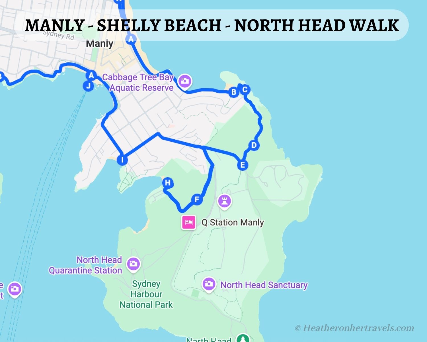
7. Manly – Shelly Beach – North Head
This delightful walk takes you along Manly beach, one of Sydney’s most popular surf beaches. You’ll also get the chance to swim in the calmer waters of Shelly Beach, before climbing up onto the headland at North Head for ocean views and circling back past harbour inlets to Manly Wharf.
To make the walk shorter, just walk part of the path above the beach for the ocean views, then return again past Shelly and Manly Beach.
Highlights – Manly – Shelly Beach – North Head
Manly Beach – From Manly Wharf walk along the pedestrianised Corso to Manly Beach, one of the most popular surf beaches in Sydney. If the surf’s high take a moment to admire the surfers, but be careful when swimming as the waves can be strong, and always stay between the flags.
Shelly Beach – On the south side of Manly beach, follow Marine Parade towards Shelly Beach. You’ll pass the rocky shore of the Cabbage Tree Bay Aquatic reserve that’s popular for snorkelers and divers.

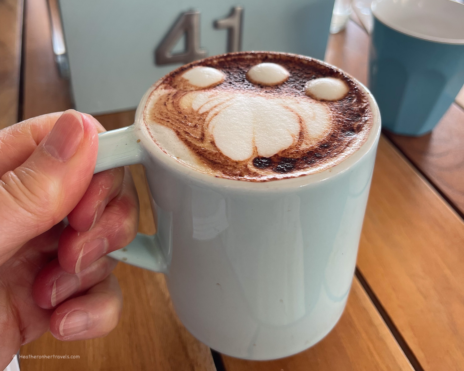
We enjoyed a coffee stop at The Bower cafe, overlooking the small Fairy Bower pool where you can swim. Continue to Shelly Beach, which is more sheltered than Manly and a good place to swim and relax.
Headland above Shelly Beach – It’s worth exploring walking track on the headland above Shelly Beach, as you’ll get some good views of surfers offshore.

Barracks Precinct Walk and Old Quarry Swamp – continue through the car park above Shelly beach and find the start of the walk to Barracks Precinct. There are some lovely views over the ocean before the path goes through a gate in a stone wall that’s easy to miss. A pretty photo stop is at Old Quarry swamp, overlooking a flooded quarry.
North head Sanctuary and Lookouts – when the bush path crosses Bluefish Road, you can continue in the direction of The Barracks Precinct, a historical military complex that was part of Sydney’s coastal defences.
It’s free to visit, with old gun emplacements nearby. If you continue on bush tracks in the North Head Sanctuary, there are some lookout points, such as Fairfax lookout and Yoningma Lookout.
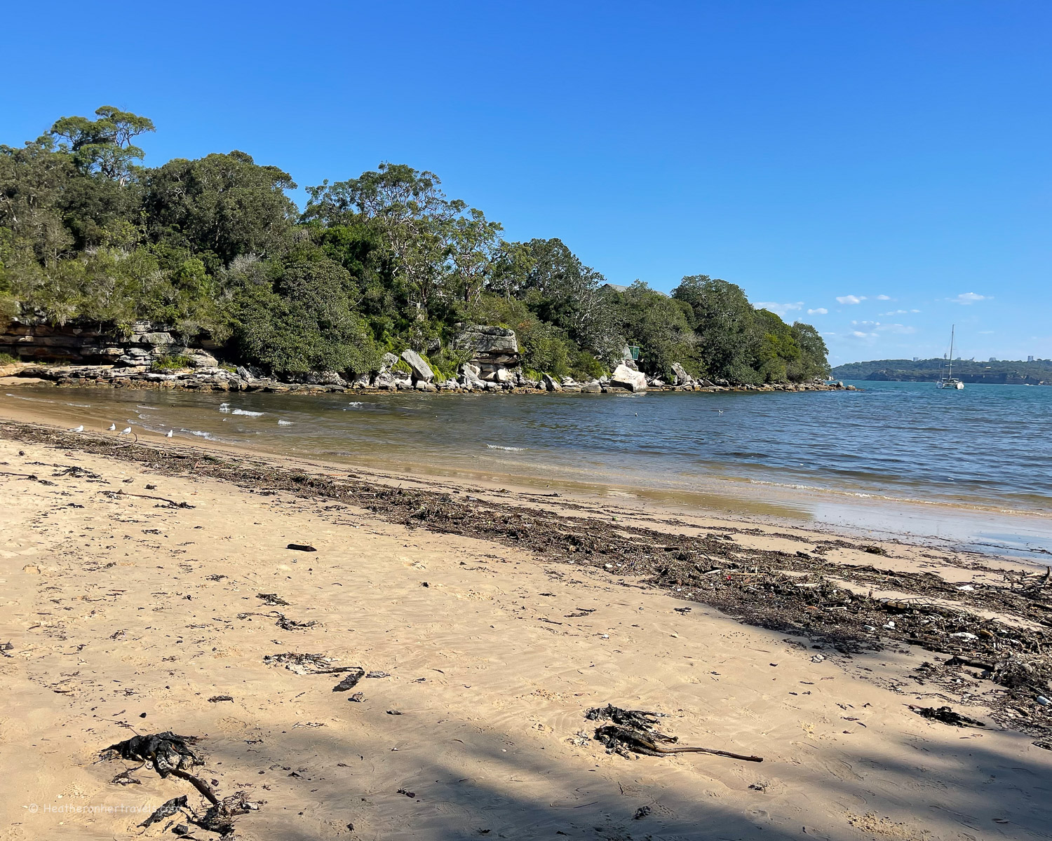
Collins Beach – We didn’t have time to make a full visit to the North Head Sanctuary, but continued down Bluefish Road and then took the lane down to Collins Beach. It’s surrounded by bush and the water here is generally calm.
When we visited a storm had just blown through, and it was covered with weed so we didn’t stop long. The path continues above the beach to Little Manly Point, past a popular spot to jump into the water.
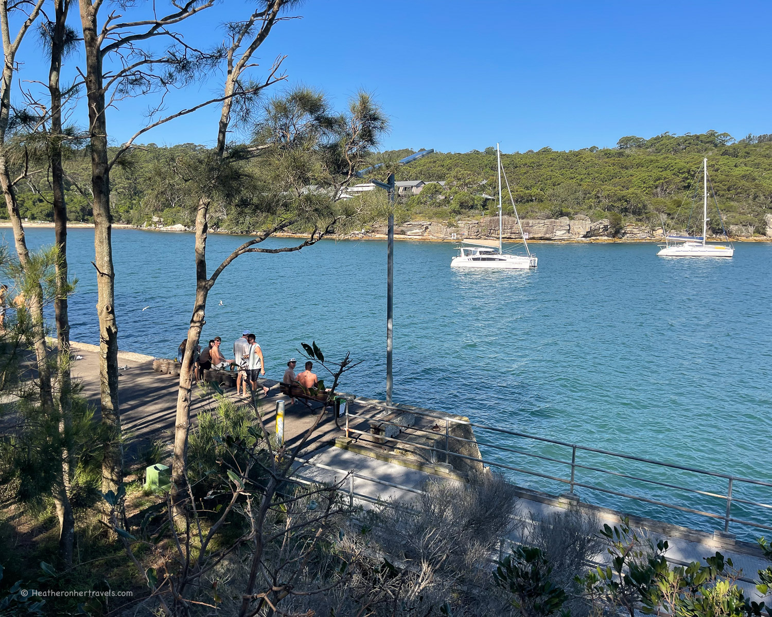
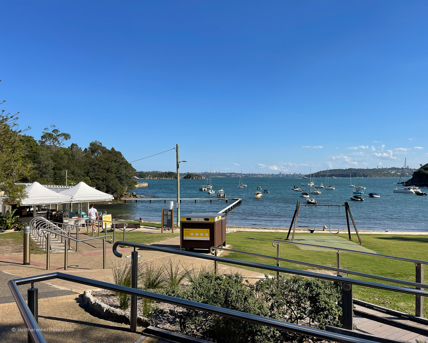
Little Manly – rounding Little Manly Point, we continued through the pretty park and down to Little Manly beach, a quiet neighbourhood spot with a cafe, that’s popular with families. From here it was an short walk on residential roads passing Manly yacht club, to reach Manly Wharf for our return ferry.
Planning – Manly – Shelly Beach – North Head
- This walk begins and ends at Manly Wharf
- This walk takes around 3 hrs – but allow extra for photo, refreshment and swim stops.
- Distance around 9 km round trip
- The walk could be combined with the Manly to South Curl Curl Beach, also covered in the article.
- Recommended Cafes on the walk: The Bower Manly, The Boathouse Shelly Beach, Ripples Little Manly
Map – Manly – Shelly Beach – North Head
Access the route map for the Manly – Shelly Beach – North Head walk here or click on image below
Transport – Manly – Shelly Beach – North Head
Ferry: From Circular Quay to Manly Wharf – runs around every 15 mins, journey time 30 mins
Accommodation options
Your main accommodation options are:
- Stay in central Sydney and take the easy ferry from Circular Quay to Manly. We recommend Pier One Sydney Harbour (mid range) A by Adina (boutique) or Ibis Sydney Barangaroo (budget), all of which are well located for sightseeing.
- Stay in Manly – we recommend checking some of the apartments close to the beach, or for a luxurious boutique hotel try Manly Pacific Sydney McGallery Collection.
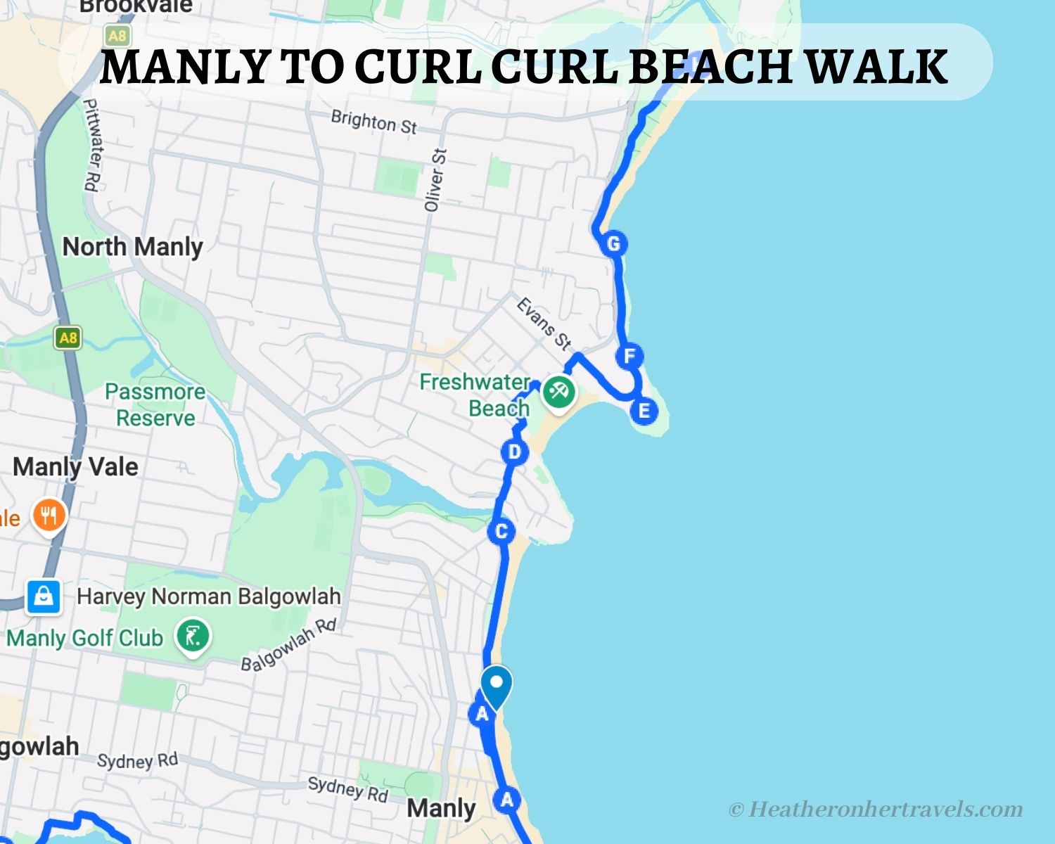
8. Manly to Curl Curl Beach
This walk follows the cliff path that runs north of Manly Beach, connecting a couple of lovely beaches that have a more local feel that busy Manly beach. It can be easily walked as an extension to the Manly – Shelly beach – North Head walk, that’s also covered in this article.
While I’ve described the walk from Curl Curl Beach, where we started, the coastal path continues north to Dee Why Beach and beyond.
Highlights – Manly to Curl Curl Beach
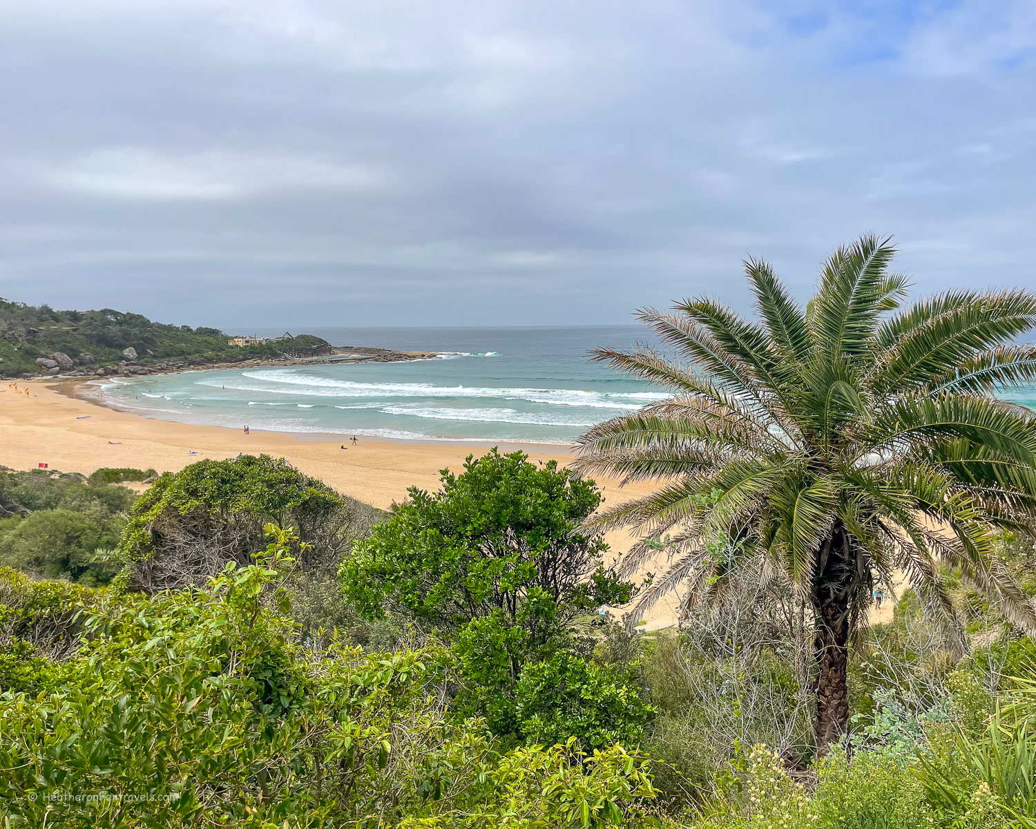
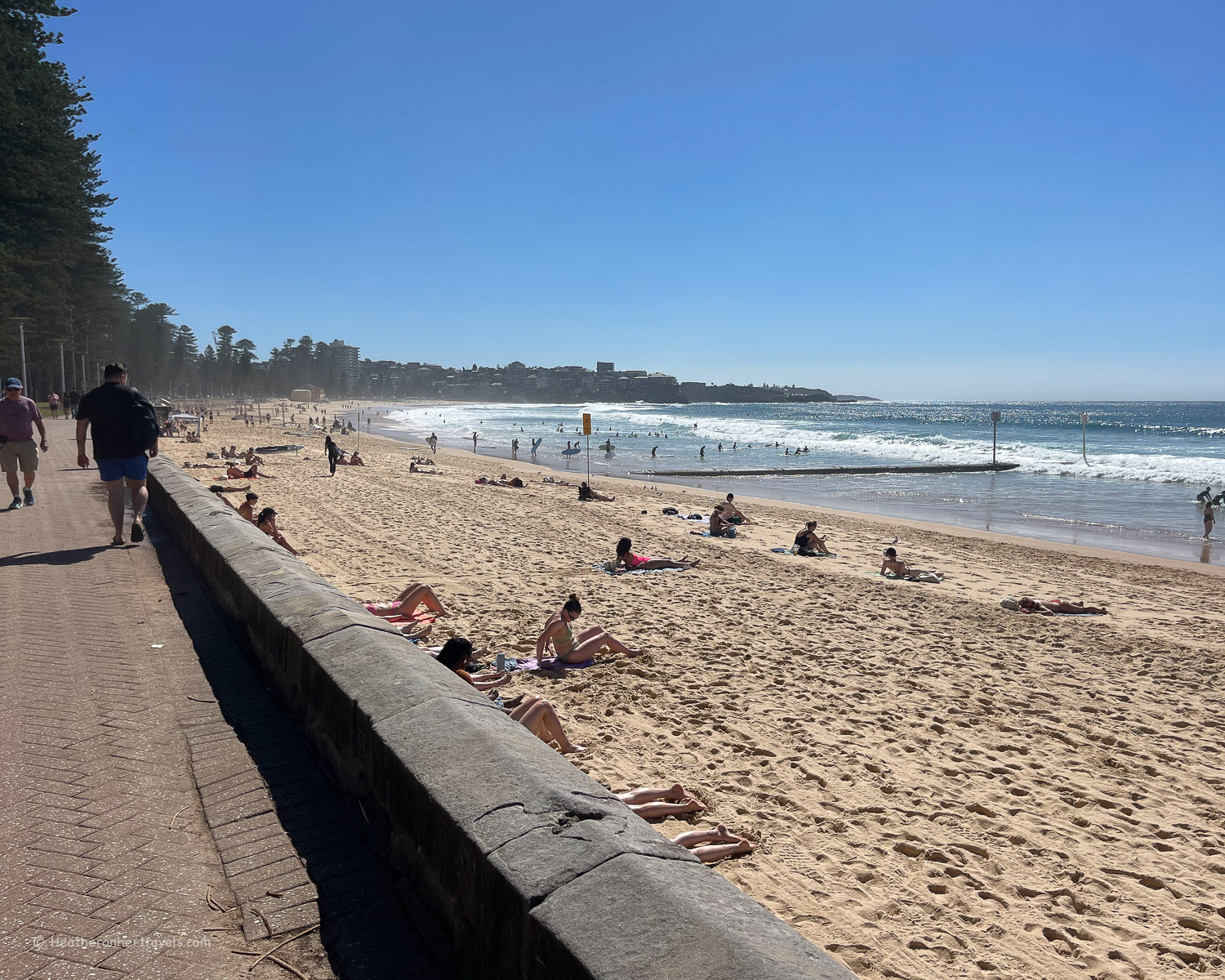
Curl Curl Beach – We took the bus from Manly Wharf and alighted at Curl Curl Beach. It’s a long beach where the surf often runs high and is popular with surfers. There are life guard stations, flags for swimming and ocean swimming pools at both the north and south ends of the beach.
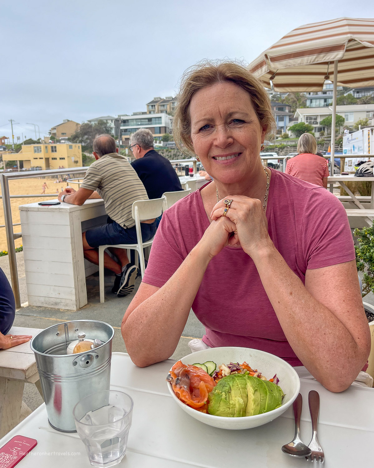
The beach is backed with sand dunes and a path above them to walk with a view of the beach. We stopped for brunch at The Beach eatery, before continuing up onto the clifftop path at South Curl Curl.
Curl Curl Boardwalk – This boardwalk hugs the clifftop, with rocky reefs below and views of the crashing waves. Before long, you’ll arrive at Freshwater lookout, where there’s a car park and the Freshwater Rockpool, a large seawater swimming pool set below the cliff.
Freshwater Beach – Freshwater beach is more protected by the curve of the cliffs than Curl Curl Beach, so it’s a good one for swimming, rather than surfing. There’s a children’s playground, car park, grassy picnic area and cafes set above the dunes that back the beach.
As Freshwater is just a short walk over the headland from the north end of Manly, this would be good place to relax on days when Manly gets too busy.
Queenscliff Beach – from Freshwater, we decided to return to Manly Wharf, catching the bus close to La Loca Cafe. However, it’s an easy walk along the residential Pavilion Street to bring you down to the Queenscliff Rock Pool and beach, an extension of the main Manly Beach.
Manly Beach – Manly is one of Sydney’s best known surf beaches, so take care if you plan to swim and the surf is high, staying between the flags where there is lifeguard cover. There are several surf schools operating on the beach, which is backed by cafes and a long promenade, so you can walk the entire length of the beach. If heading back to Central Sydney, walk along The Corso, to return to Manly Wharf.
Map – Manly to Curl Curl Beach
Access the route map for the Manly to Curl Curl walk here or click on image below
Planning – Manly to Curl Curl Beach
- The walk can be made in either direction, but we took the bus to Curl Curl Beach, then walked back towards Manly.
- This walk takes around 2 hrs – but allow extra for photo, refreshment and swim stops.
- Distance around 7 km one way
- Recommended Cafes on the walk: The Beach Eatery at South Curl Curl Beach, Shaka or La Loca at Freshwater Beach, there are numerous cafe options around Manly Beach.
Transport – Manly to South Curl Curl Beach
Manly: Ferry from Circular Quay to Manly Wharf – runs around every 15 mins, journey time 30 mins
South Curl Curl Beach: Bus 166 or 167 between Manly Wharf and South Curl Curl Beach – runs around every 30 mins, journey time 30 mins
Accommodation options
Stay in Manly – we recommend checking some of the apartments close to the beach, or for a luxurious boutique hotel try Manly Pacific Sydney McGallery Collection.
Other planning information
- There are numerous public toilets, water fountains and cafes along each route – it’s unusual to walk more than 30 mins without finding these facilities at a beach or park.
- In hot weather make sure you carry water, wear a hat and sunscreen. The sun in Sydney is deceptively strong, even on cloudy days.
- These walks are mostly flat, although there may be gentle slopes or steps in places. The walks are on well paved and maintained coastal trails, although they can be a bit rougher when passing through parkland areas.
- These walks are easy to moderate and can be walked by anyone with reasonable fitness. Walk in trainers or hiking sandals that have a bit of grip.
- While I’ve given local accommodation options, all these walks are easily accessible from Central Sydney, using ferries from Circular Quay (the main ferry terminus) or buses from CBD (Central Business District)
Read Next
Read about how to spend One day in Sydney – an itinerary for first time visitors

More to see in Sydney
The Bondi to Coogee walk – a scenic coastal trail in Sydney
Pin it
This article is originally published at Heatheronhertravels.com
Never miss an update! – Subscribe to receive our latest articles and newsletter